Day 5 - Kathmandu to Lukla
After so many days of suspension, even the most excited traveller also will become sian-one-half liao already, that is if we really still fail to fly on Day 5.
Thus, on this day we all Fell-in, dumped our luggage, dropped ourselves onto the bus seats, waited at the Kathmandu domestic airport, and just hoped for the best.
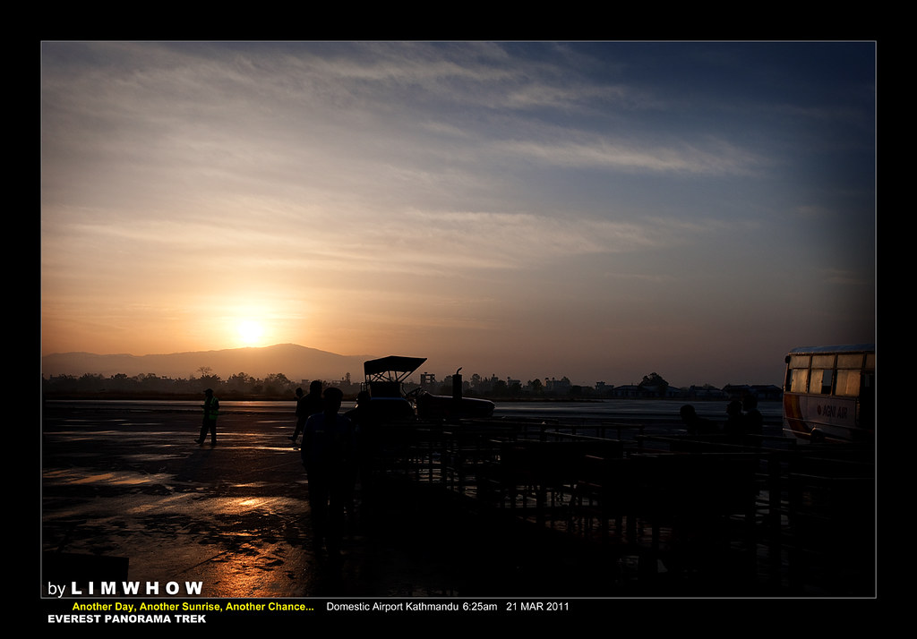
Kathmandu domestic airport's security isn't the most fantastic.
Acrux and I were able to sneaked past the security guards to reach the grounds of the outside.
... and to snap a sunrise shot of Kathmandu - my very first Kathmandu sunrise shot.
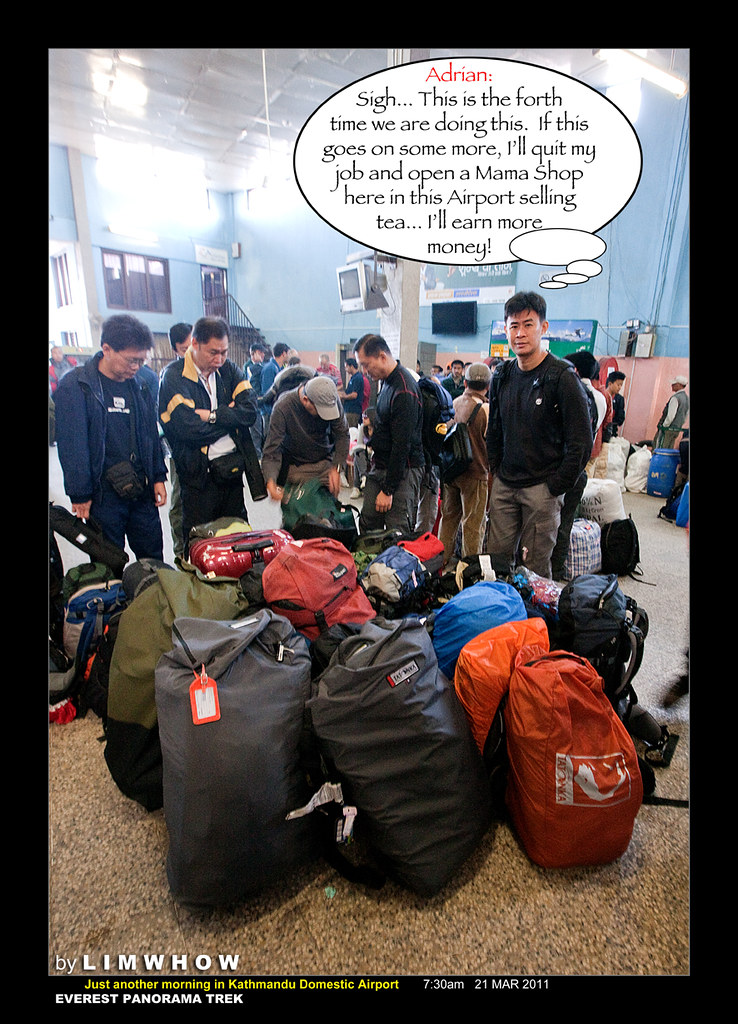
Adrian seemed to have discovered a better way of making heaps of money rather than doing this high risk job that he is currently doing...
Just before 8am, we got news that Mahesh, our main Nepali guide, had banged some tables and switched us from our original airline to SITA Air.
This was done for the greater interest of the whole group as SITA Air was able to fly us off really quickly instead of being pushed ALL the way to a much later flight.
Of course, he seemed to have conveniently forgotten that the very last mishap in October 2010 that occured at Lukla Airport involved a plane from SITA Air...
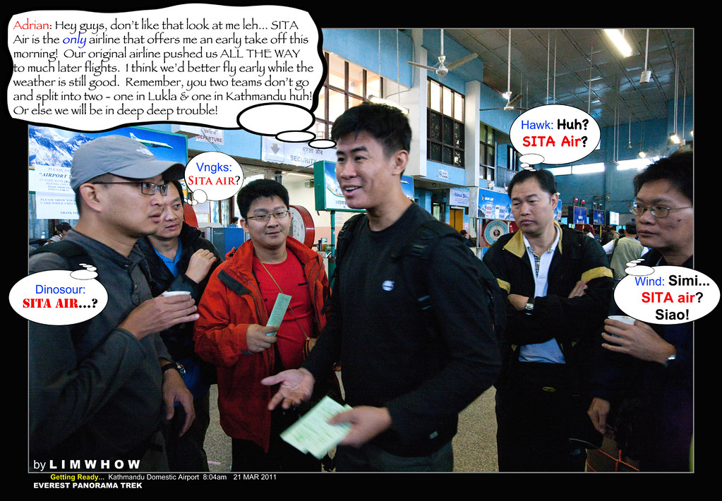
Whatever it was, the choice was not ours.
If there was a chance to land at Lukla, we would just grab it.
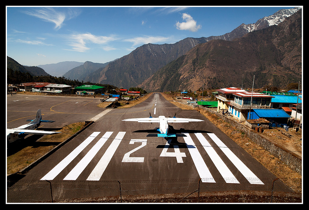
And here, was a record shot of us doing just that...
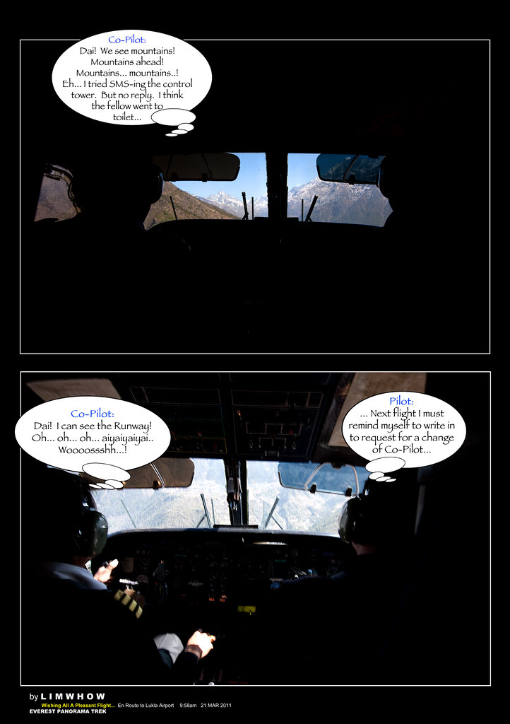
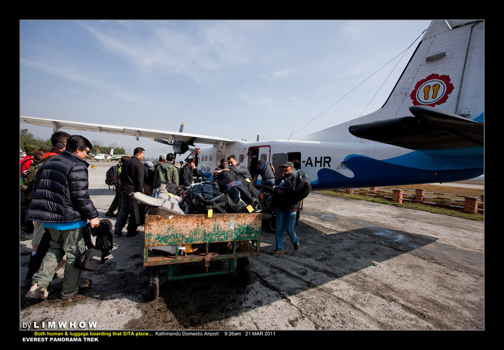 One of Our Most Exciting Flights... ever.
As if being squeezed into a single-row-each-side teeny-weeny one-propeller-on-each-side plane was not nerve-wrecking enough...
The fact that we could actually see what the Pilot and the Co-pilot was doing was no barrier (door) between the passengers and the cockpit was an eye-opening experience (if not more nerve-wrecking as we approached the mountain valleys and the runway) in its very self!
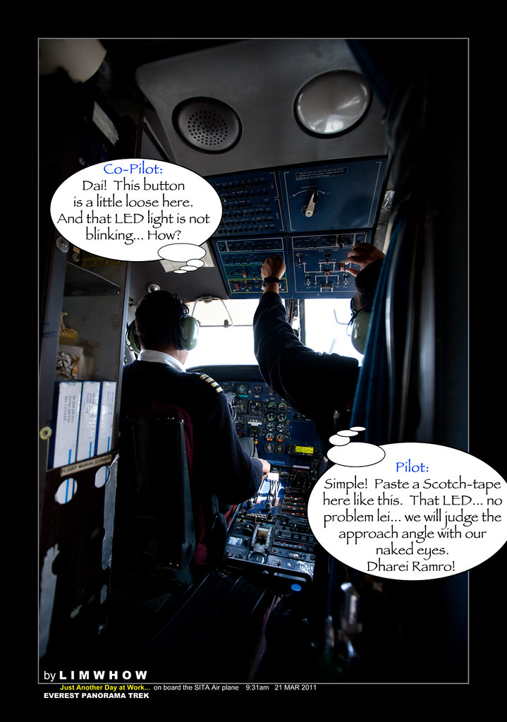
By now, we all have acquired some Nepali terms already.
And most of us know that Dharei Ramro means 'Very Good'!
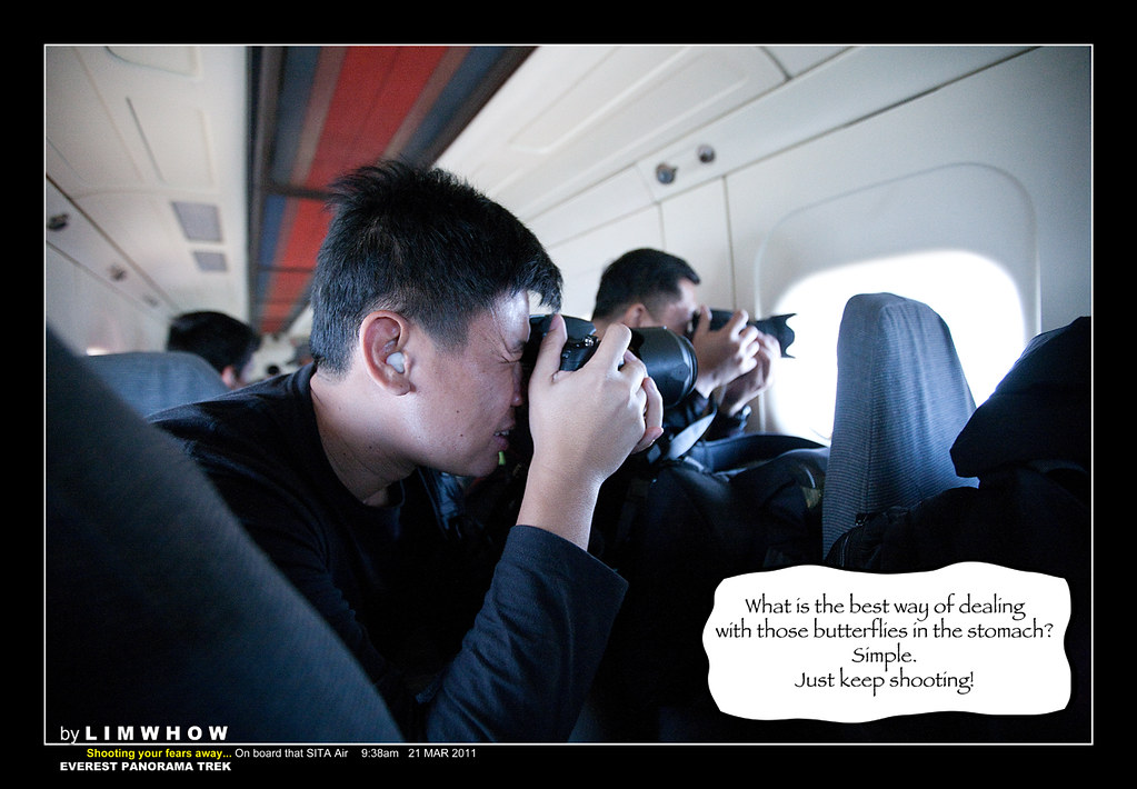
And it's only natural that the instinct to preserve the moment for posterity kicked in, and Adrian and Wai Kit, and every one else started snapping away almost non-stop while on this 30 minutes flight.
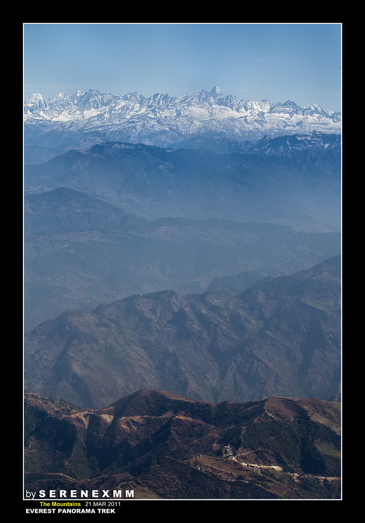
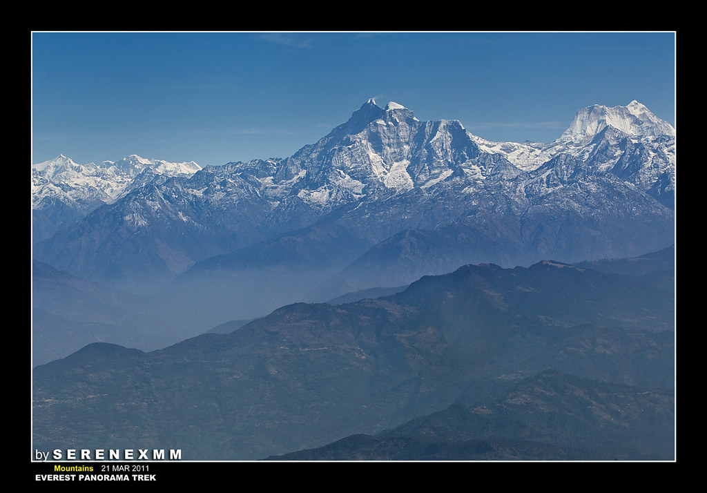
We saw the Himalayan ranges and the Middle Mountains.
Some mountain shots from the SITA plane by Serene...
"Here are some of my shots of the mountain from our airoplane. The window has got marks so it is very hard to shoot. Don't know can make it or not.
SereneXMM #11
SereneXMM #12
Here is another Mountain when we flew in the airplane.
On this day, we were in team one and we took off first. It was sheer exhilaration to behold the mountains coming closer and closer to our plane as we edge towards Lukla. But honestly, the runway of Lukla Airport came up quicker than we expected. I just managed to lift up my camera and the runway was already in sight!
Hearts thumping, hands cold and clammy, lips dried and cracking - we all sat with breaths abated...
Landing of our STOL plane at Lukla Airport
Here, Wai Kit caught a beautiful shot as our plane approached the runway of Lukla airport. this was that defining moment.
[Click on the photo below to go to Wai Kit's original post in ClubSNAP]
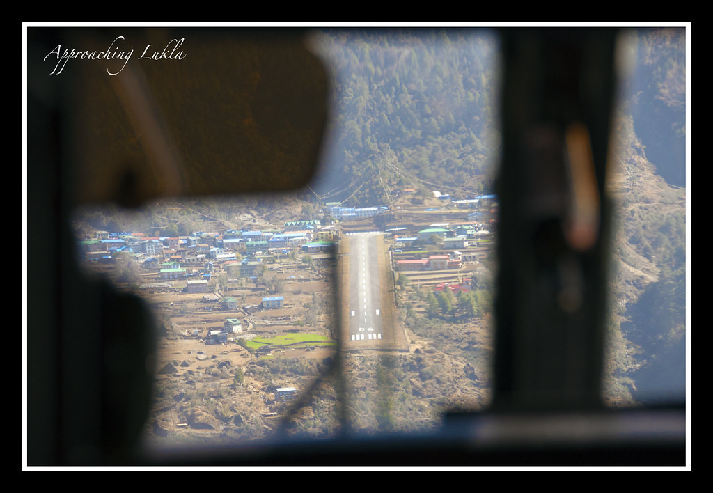 |
| "Runway in sight!" [Photo: Cheah Wai Kit] |
No jolts, no bumps, no turbulence, almost nothing.
Before we knew it, the Pilot and Co-Pilot have done a most wonderful job of landing us in Tenzing-Hilary Airport (for ease of remembering, we'd just call it Lukla Airport lah...).
EVERYONE was cheering, as though they have gone through a most life-changing experience.
Even Baboo, the guide, was cheering with us... Hahaha...

Jokes all aside, the Pilot and Co-Pilot were most professional in carrying out their duties. And I must say, it is with flight crew like this that the incidence rate continues to be low.
My salute to ALL the flight crew on the flights to Lukla!!
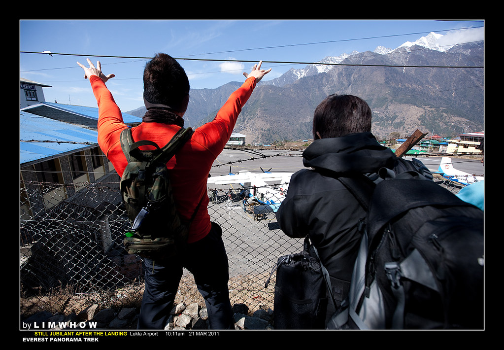
Finally... at Lukla Airport...
I remembered we stepped out of the plane onto the tarmac of the airport ground. We were all really a little lost and didn't know where to head towards nor what next to do. Must have been the total flooding of our senses by the flight and the landing.
But what I remembered distinctly was this solider who was very insistent on our getting out of the compound, out through a rusty gate to where many Sherpa porters were waiting for us outside, together with our luggage. Despite Adrian's pitiful begging, he still disallowed us the luxury of staying inside the compound to wait for the landing of our Team 2.
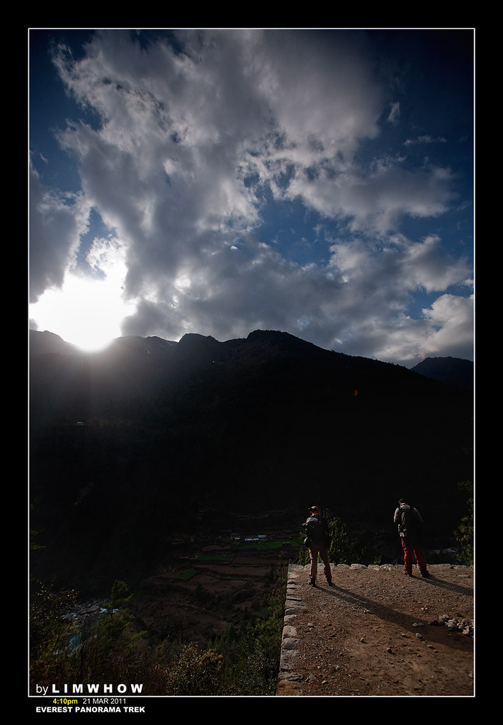
It must have been the clear air high up there at 2800m, for the sky was really a deep blue.
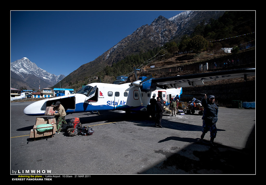
... and just for us to remember by, this photo was Geotagged to this spot. But it was interesting when I looked closely and discovered that we were truly in the middle of the mountains, in a tiny airport of a tiny town.
Here is a small humble video shot of mine from just behind the cockpit of the landing of flight one...
Landing of Flight 01 at Lukla Airport with all those crazy fellow screaming their lungs out...
Our good friend Kai Sing took a shot of the infamous Lukla Airpot from this angle..
[Click on the photos below to go to Kai Sing's original post in ClubSNAP]
 |
| A shot of a plane getting ready to take off. [Photo: Ng Kai Sing] |
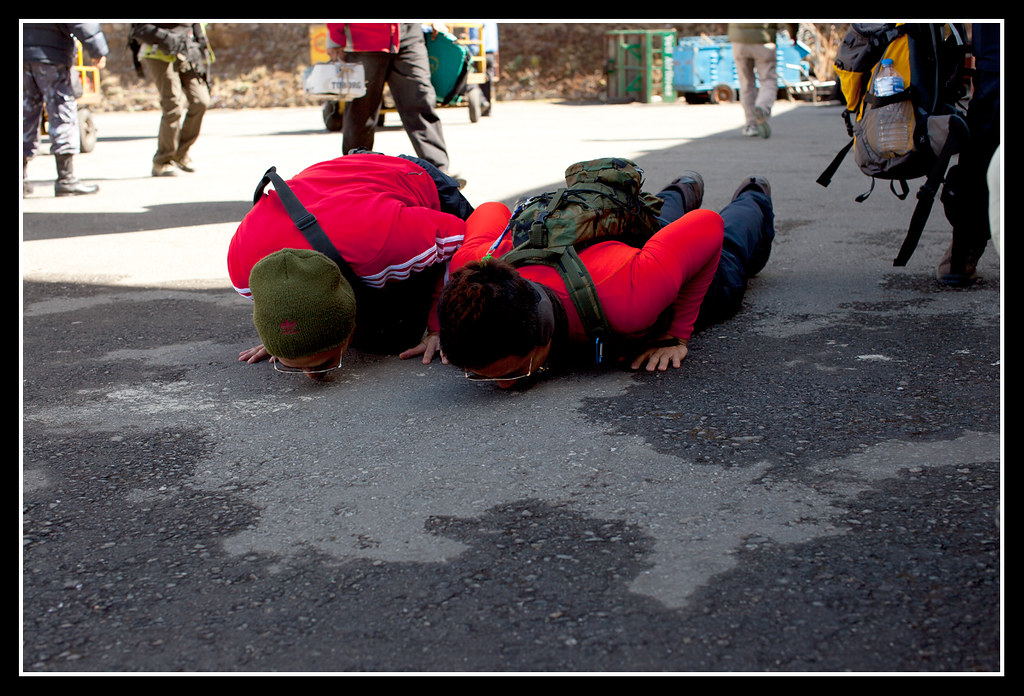 |
| The Lukla Ground kissers.. Goose and Johnny! [Photo: Ng Kai Sing] |
Continuing where we left off...
T R A V E L O G U E
LUNCH at Lukla
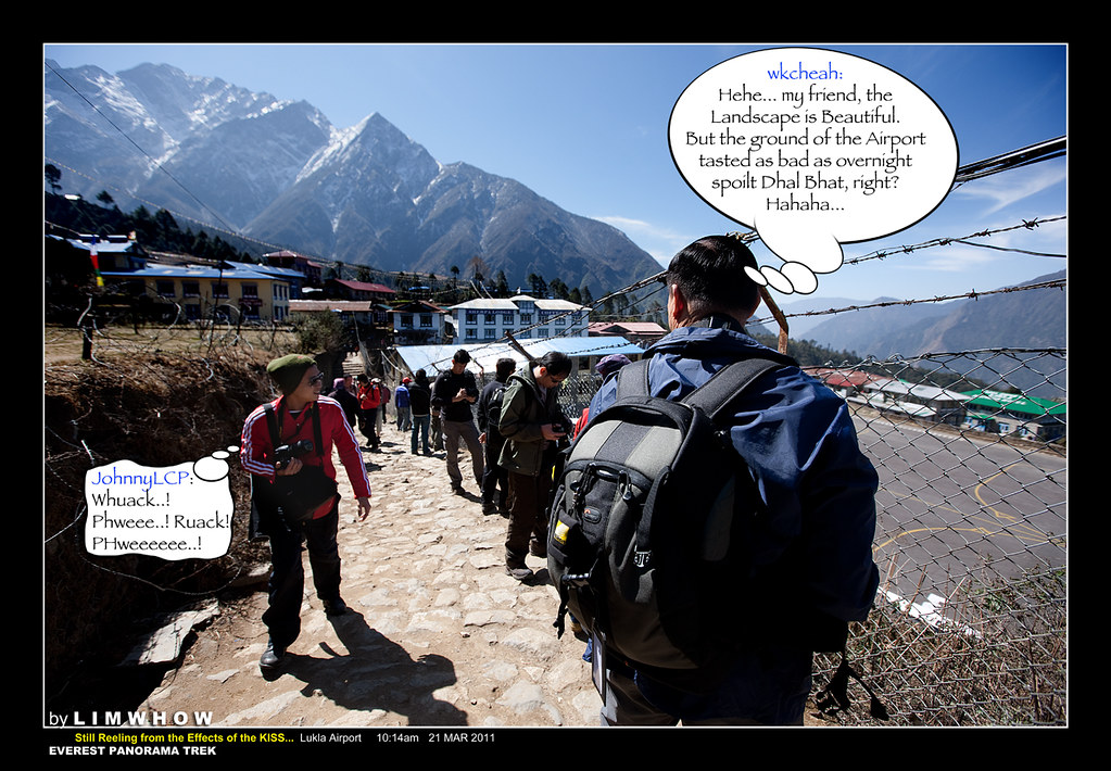
Honestly, for some strange reasons, the inclined climb from the Lukla Airport up the slope at 'Viewing Wall' end of the Airport was quite siong for me. I recalled panting and panting like a Yak as I reached the top of the wall. And looking up, I briefly spied SereneXMM and Goose Goi spreading their hands like the Tibetan Vulture welcoming our Team 2 flight as our fellow travellers streamed out of the just-landed plane.
These two were absolutely crazy! They were still in jubilant mood while I was already experiencing Stage 1 Acute Lukla Sickness (ALS) already...
Dragging my feet further, I turned back and this time round was very happy to see finally, at least another member who was suffering in as much the same degree as I was in terms of discomfort, but possibly from a different source...
Yah... the brave men, both Johnny and Goose Goi were...
The Video of our SITA air plane taking off and flying back to Kathmandu..
Video of our plane taking off at Lukla aiport.
Right at the fence over-looking the Lukla Airport... Just as Kai Sing and every one else were taking shots after shots of the planes at the airport, I saw the plane for our first team getting ready to take off. I took a video of it to remember how it did it...
But I certainly knew of a great shooter both in and out of the Range, who was in HIGH spirit (possibly due to the HIGH altitude??) who was all smiles and ready to devour any Yak that came along his way.
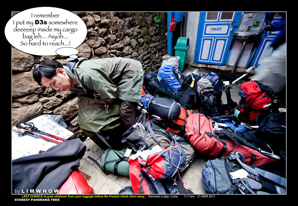
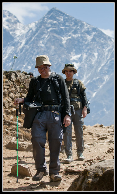
Here we were walking down to the Namaste Lodge where we would be having our first lunch up at 2800m and where our luggage are being divided among the porters who were raring to race off to the next stop with all the load...

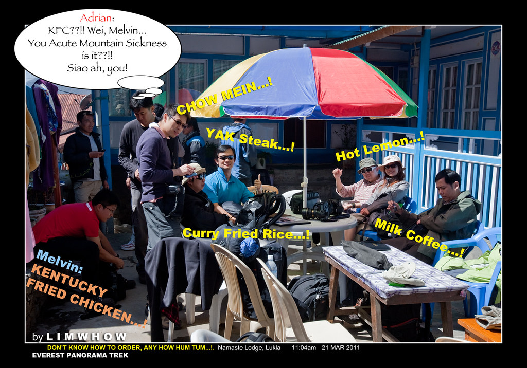
If we were to say at 11am on that fateful day, it was NOT hot in Lukla, we would be telling a big big lie.
For the sun was scorching like a Dropkyo on fire, and the cold, crisp air did nothing to filter the burning effects of the Ultraviolet rays on our skin. Even sitting under the big umbrella did almost nothing to help cool our charred hair pores.
It was a little confusing, first time ordering Sherpa-Nepali-Tibetan food high up there and we were most likely pretty lost what to get before we started pumping our thigh muscles. What I personally found amusing was, despite the scorching sun, every one was ordering hot chocolate, hot lemon, hot tea, hot milk coffee... I would have loved a cold Coke, except that I was too concerned about making SgTrekker Pok-Gai on the first day.
Who could forget we all walking down to the holding area 2 by 2, by 3 by 3... just to get our trekking poles, extra water bottles and whatever we wanted to be on our bodies, because the strong and sturdy Sherpa porters were all ready to shoot off with our heavy luggage.
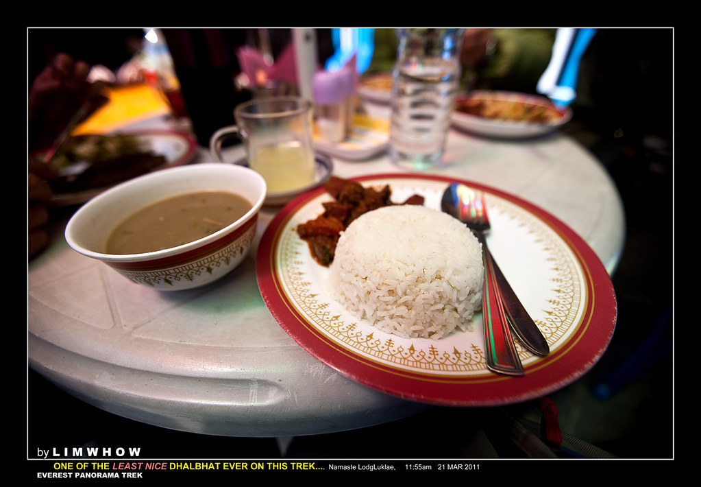
Adrian and Melvin said Dhal Bhat was something that MUST be tried up here in Everest Country. So I guai guai obeyed and ordered my first, and my last Dhal Bhat on the trip.
T R A V E L O G U E
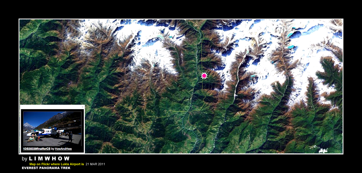
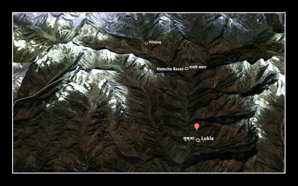
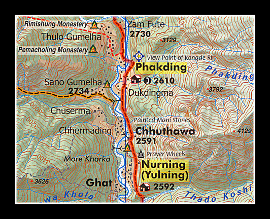
Some Data and Map for our Trip from this point onwards...
The problem with having too many flights and too much strenuous trekking (at least to some not so old ones of us) means that we often missed out certain important data that would make the trek and the trip much more meaningful.
And it is with this very aim that our good friend Dinosour gotten his iPhone4 loaded with a wonderful GPS App, and that I tried using my Garmin Oregon throughout this trip.
I have uploaded all the GPS information from my Oregon to Garmin Connect and it churned out some info for me. Here is some of the trip information of our Flight from Kathmandu to Lukla. The flight distance is 150km.
Our trek right after lunch from Lukla town to Phakding was almost 9.88km, according to my GPS, which I believe is very similar to Dinosour's EveryTrail App.
We rested at Namaste Lodge for lunch (which was at 2860m altitude) and walked to the small village Phakding which was at 2616m elevation.
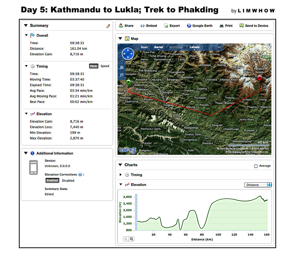
If there are any mistakes that I have made, please Ladies and Gentlemen, correct me so that we would have as accurate information as we possibly can at the end of the day. Thank you all in advance!
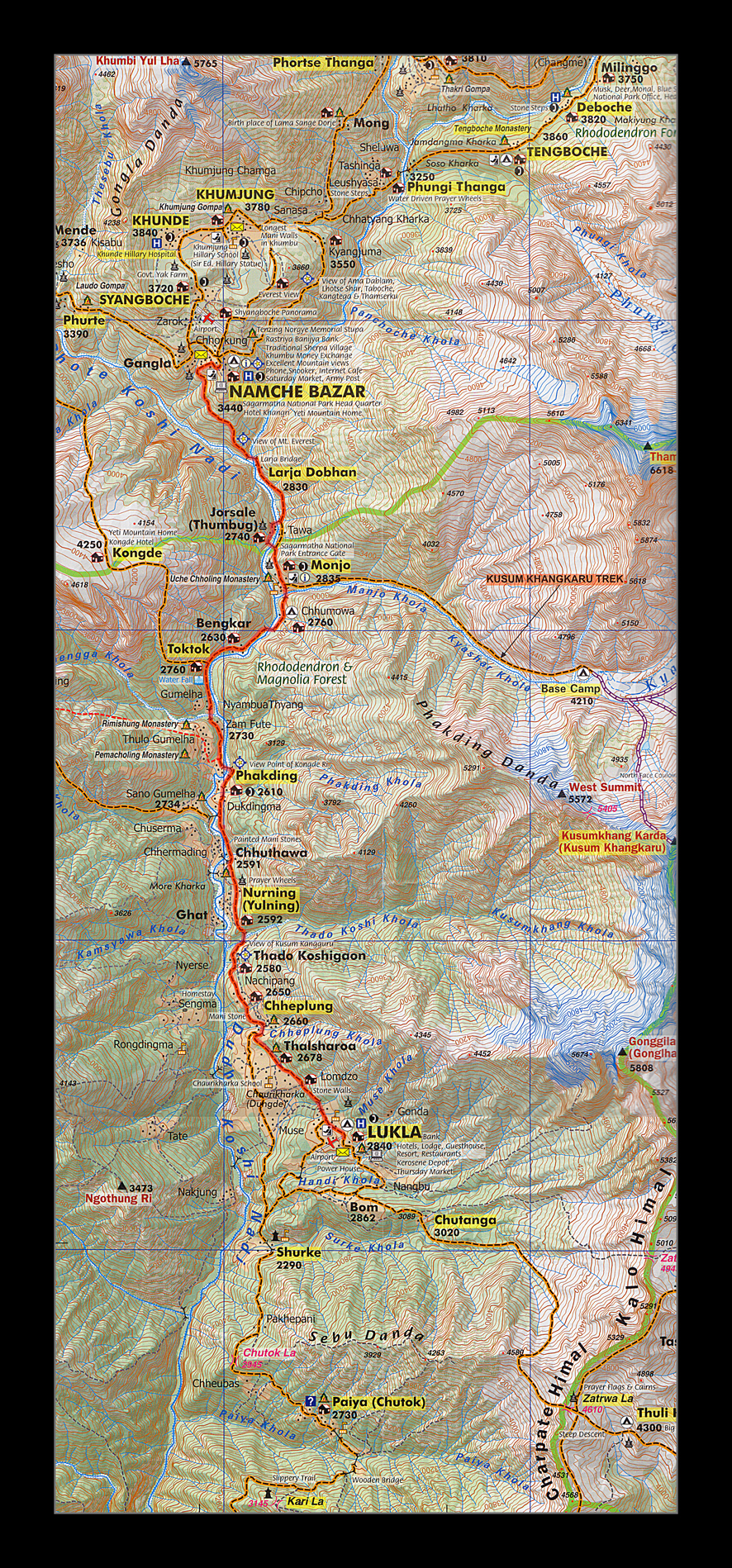
The Map of our Trek from Lukla to Namche Bazaar
(and for some of us, all the way to Syangboche some more...!)
I have a small little map here which I have marked out our full trek up to Namche Bazaar from Lukla and back to Lukla, marked out with a thicker Red route (as can be made out below.).
This will be the map that I will try to refer to as we continue our Trek further north.
T R A V E L O G U E
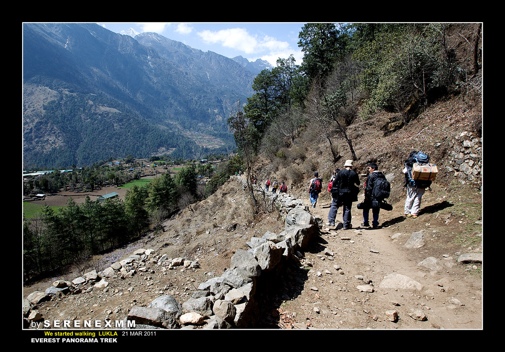
Trekking out of Lukla Town
Adrian and Melvin wasted no time.
Lunch was over in a jiffy and we started trekking officially at 12:30pm.
We wanted to start earlier to give ourselves more time ahead to ease into the trekking rhythm.
Lukla was a delightful town, kind of a frontier town, if one may like to think of it this way. It had small little shops selling anything from religious trinkets to food, water, clothings, sports-wear and even fake North Face cold wear and trekking poles, whatever you needed as a last minute shopping before your trek.
Of course prices are no longer as cheap as way down there in Kathmandu.
A bottle of boiled water (not mineral water) would cost 60 rupee here while a bottle of mineral water would only cost 10 rupee in Kathmandu.
There were lodges of all klinds, and of all levels of comfort, and yes, to our team members' delight, even a Starbucks Cafe.
Pubs, watering spots and eateries were aplenty, a true reflection of the amount of tourism dollar (rupee) from which the folks here derive their income.
"The walk from Lukla to Phakding is really easy peasy," reassured Adrian. "There will be lots of downslope as you walk, and we will lose about 200m of altitude from where we are here at Lukla to arrive at Phakding which is around 2610m. This trek will take a fast trekker two and a half hours, and a slow trekker about four hours. But remember, this is not a race and I want you all to take your own sweet time and enjoy this easy walk. "
Easy my foot...!
Walking down slope exerted much more strain on our already young knees. And fortunately, Kai Sing, Acrux and Wai Kit reminded us again and again to bring a pair of knee guards. Otherwise I am sure both mine and SereneXMM's knees would be the first set of casualties on this uneven track.
Right out of Lukla, our first companions that we found trodding alongside us was this pair of Dropkyos.
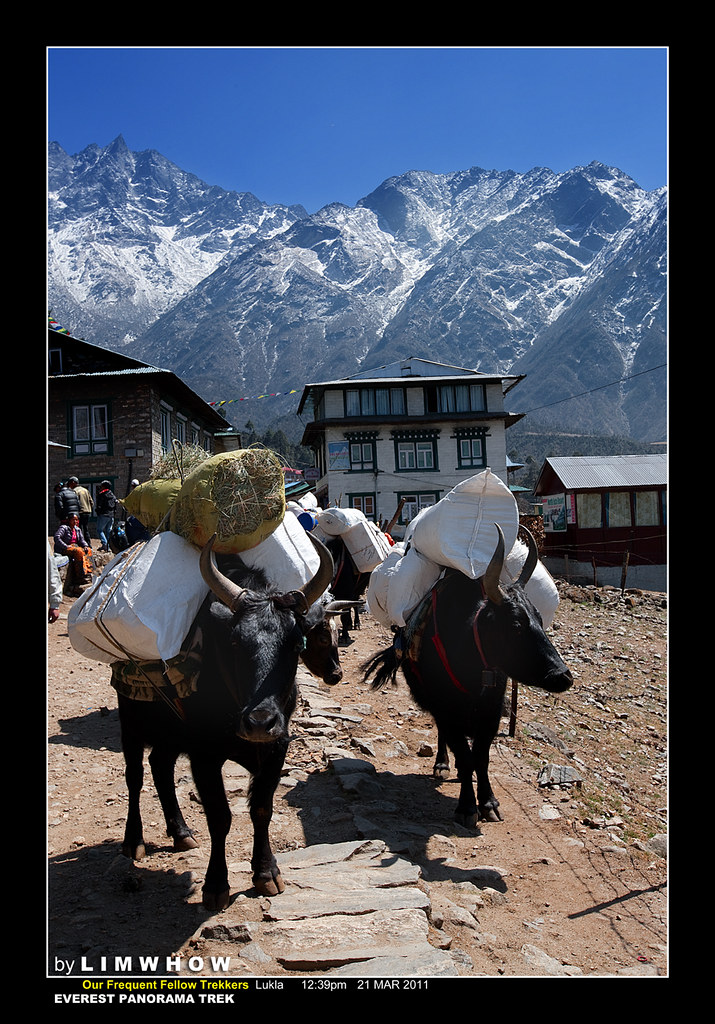
Dropkyos were a mix-bred between Yaks and Cows. They were hardy animals with good endurance and good milk-production. And compared with the Yaks, they were much more tame in their nature and were able to be used for ploughing, something which would be totally impossible with the Yaks. In addition to that, Yaks survive well at altitudes of 3000m and above, whilst their Dropkyo offsprings could do well below that level.
The way to tell Yaks apart from Dropkyos? Yaks have much longer hair that extend to their limbs, compared with the Dropkyos. So usually one look, we could already tell.
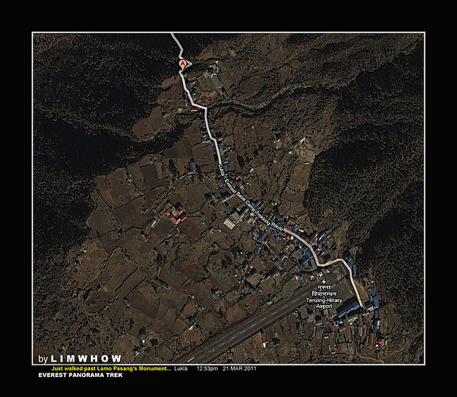
We walked to the end of the small town of Lukla and walked under a monument of a famous female climber Lamo Pasang and we were out of Lukla already.
The track turned sharply downwards as we made the first right turn.
And here is that location A where I saw my fellow team mates already walking waaaayy ahead of me...
Ahead of me here as I rounded the corner and saw to my dismay so many of my mates so far ahead negotiating their first gentle climb...

Every time I looked at this photo above, I wondered to myself, who was those fellow in front. And I just finally enlarged it a little.. and realised that just walking beside Mahesh was our good Francis Chia in lime green, and beside him was Kai Sing. Behind them was Sherwin Ting girl friend Amelia... Not far behind was our good Patrick Papin!

Serene took this picture while we are walking. The road was flat and nice to walk. The second photo was the Google Map GPs showing where she shot the photo.
SereneXMM #13
SereneXMM #14
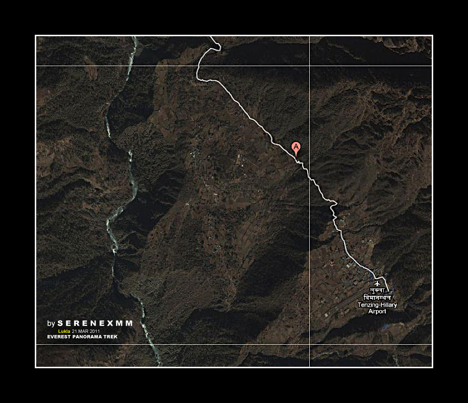
The EXACT GPS location of the shot.
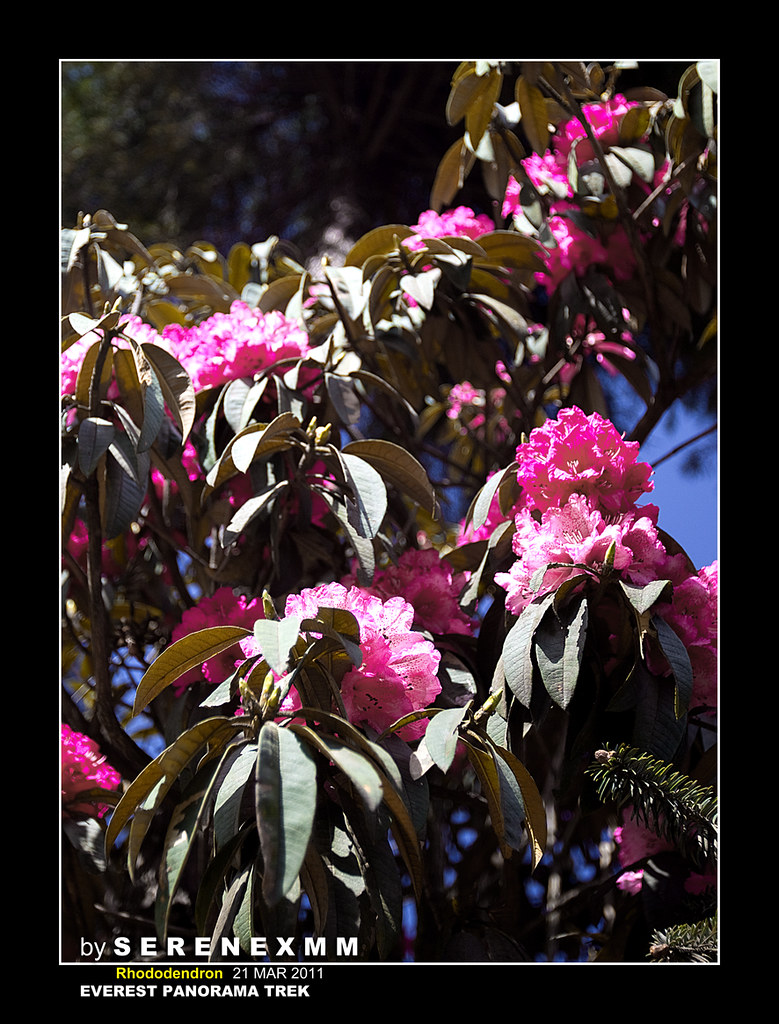
Wherever we walked to we see many of this flower. It is the Rhododendron flower and has got many different types of colours. Here was a shot by Serene...
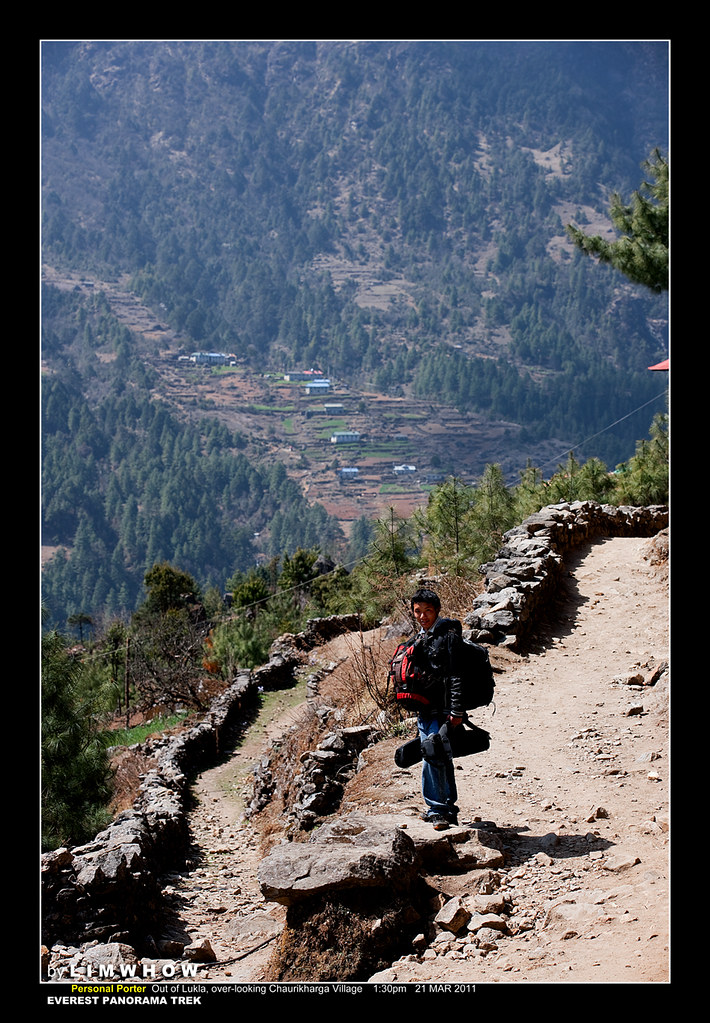
Coming to viewing the Chaurikharka Village
A few of us had requested for personal porters to carry extra camera gears and other equipment. And these personal porters would walk at our pace so that we had access to our stuff during the trek. Many of these porters are tough but very young Sherpas. Their ages ranged from 16 to 25 years old, and they were a cheerful lot, never showing black faces and forever smiling and pointing out places to us and trying to communicate with what little English they knew.
We had been walking for an hour already and finally here, we found ourselves over-looking the Chaurikharka Village with the Chaurikharka school from atop our high vantage point on the track.
From where we stood here at 1:32pm, we looked up north afar...
... and saw a magnificent peak shrouded in clouds. I really didn't know the name of this peak, but I could only guess that it was one of those few mountains that was visible from the photo above.
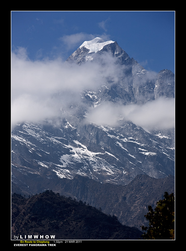
And over the course of the next few days, we would be seeing again and again, peaks of higher and higher altitudes, reaching out from among the greenery of the near ranges, with the river roaring beneath in the valleys. What sights were these!
Indeed, these were exactly what we came here for!
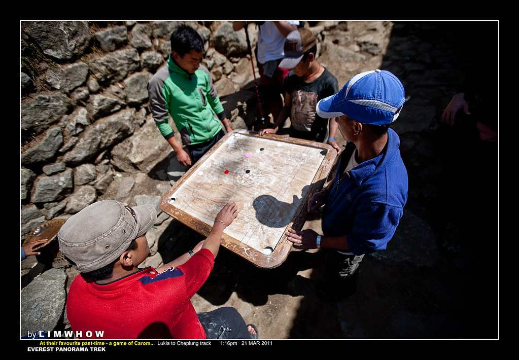
And yes, one of the Sherpas favourtie past-times was playing Carom.
And we couldn't have come across a bunch of them enjoying the game sooner.
Right at the end of Lukla we already saw our first game of Sherpa Carom!
An Infrared Shot of Chaurikharka
I was talking to Wai Kit even before this trip that we should, no matter how heavy it would be, bring our IR (infrared) cameras up to Everest Country and take back with us some IR shots of this beautiful land high up nearer to heaven. And here I found, at the view point towards Chaurikharka, my first IR opportunity.
Humbly, here is my 535nm IR shots, rendering this scene a dream-like, far-away appearance...
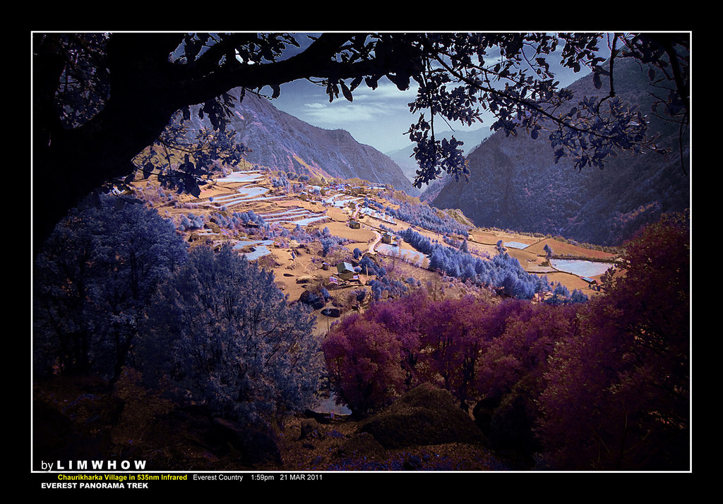
Here was a shot by Adrian, of exactly the same scene just a little further down from my IR shot. The mountain is still the same:
 |
| En route to Phakding. Photo: Adrian Loh SgTrekker |
T R A V E L O G U E
Coming to Cheplung
Cheplung is a very small village just after Lukla.
On this day, it took several of us about one hour and forty-five minutes to reach Cheplung, which was really miserable speed. A few of our super-fit members were already far ahead and almost reaching Phakding already.

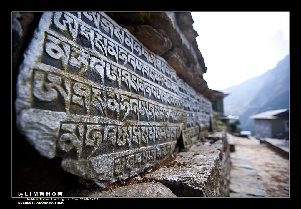
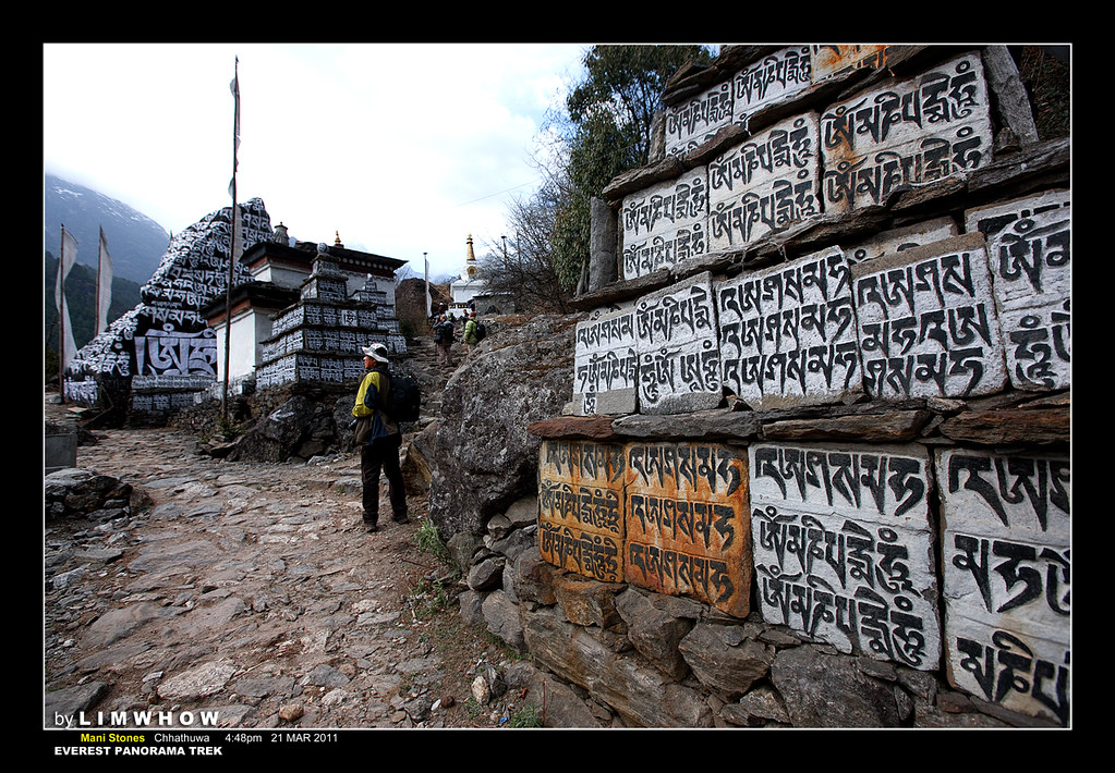
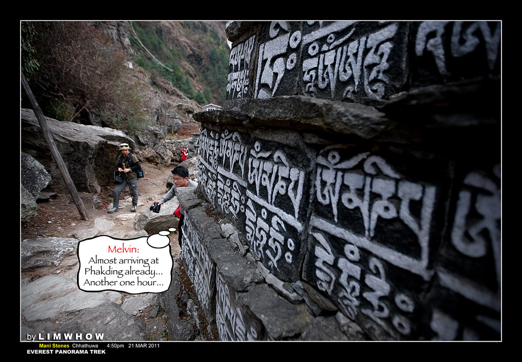
What was unique about Cheplung was that located in this village was a Stupa and a stack of Mani Stones (Prayer stone slabs carved with scriptures).
Here was a shot of Serene and myself taken by Kc Tng.
[Click on the photo below to go to the original post by KC Tng on ClubSNAP]
 |
| Me and Serene enjoying a most lovely stroll. Photo: Kc Tng |
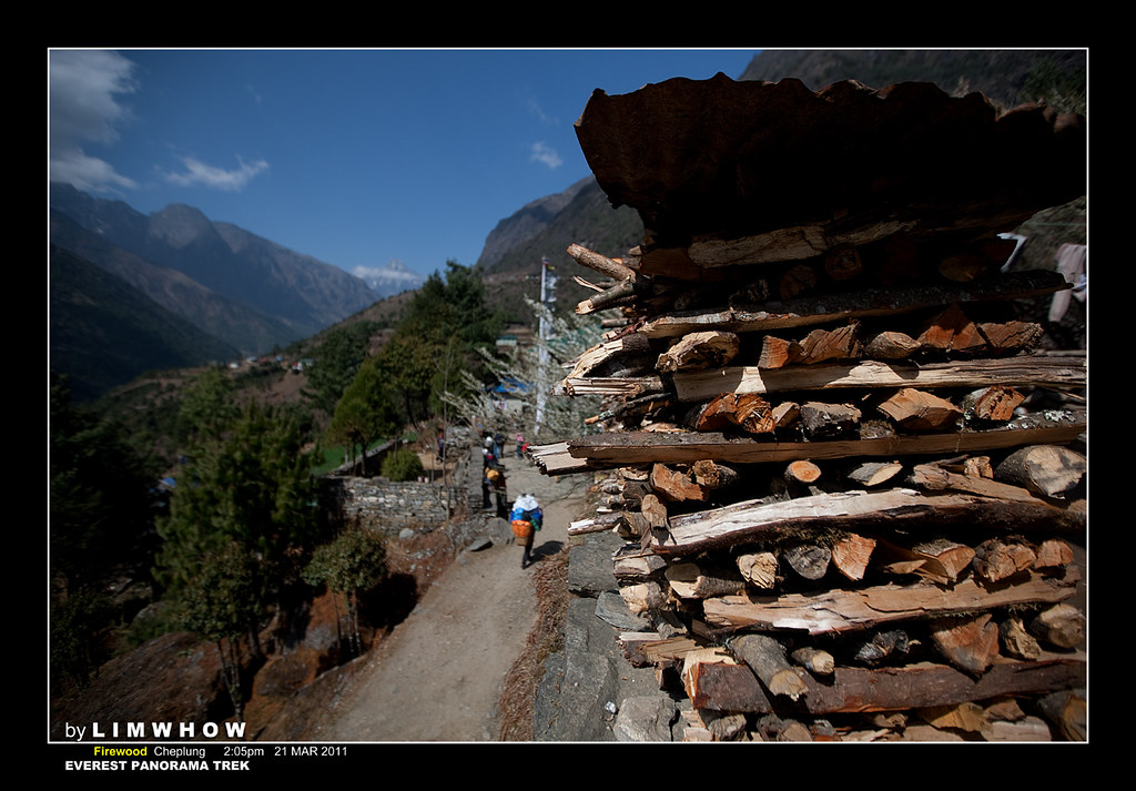
Approaching Cheplung, we came to some firewood. Remembering well what Adrian said about not allowing burning of firewood in the Everest Country particularly more so in Sagarmatha National Park (Namche Bazaar was located in this National Park), it was well known that although the local government disallow burning of timber as firewood by foreigners, the locals were still allowed to do so, ironically.
Whenever we come to a Stupa (a Buddhist monument) or a stack of Mani Stones, it is customary to walk in a Clockwise fashion around it instead of Counter-Clockwise. Even if that meant that one had to detour slightly off his track, it would still be respectful to carry that out. In fact, looking very carefully at the Sherpas, it was observed that they (almost) never fail to walk in a Clockwise manner around the Mani Stones and Stupas.
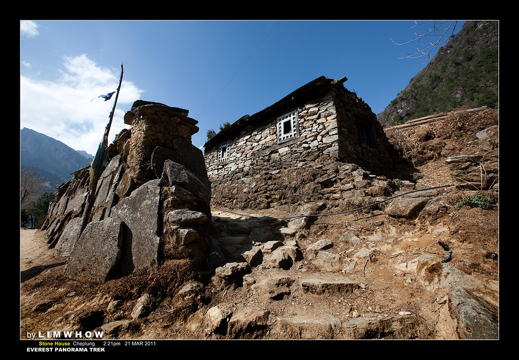
And here at Cheplung, we would begin to see stone houses that we'd soon learn were the typical building style in this part.
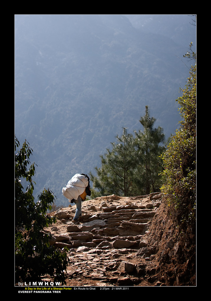
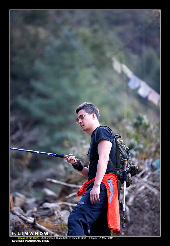
As we passed Cheplung and made our way to the tiny villages of Thado Koshi and Ghat, we saw more and more Sherpa porters carrying phenomenal weights balanced using a band across their foreheads. The would walk with slow but steady steps, and interestingly we would observe them walking a short distance before leaning back against their walking stick or the wall of the cliff to rest for a few minutes before moving off again. It has been found that the Sherpas were one of the most efficient walkers and carriers, and could easily carry 80kg-90kg of weight up huge distances.
At this juncture, I must show a picture taken by Kai Sing of one of the porters carrying his own load of 120kg. Not hired by us. Adrian forbade us to load any of our porters a single gram more than 40kg. [Click on the photo below to go to the post by Kai Sing on the original ClubSNAP thread.]
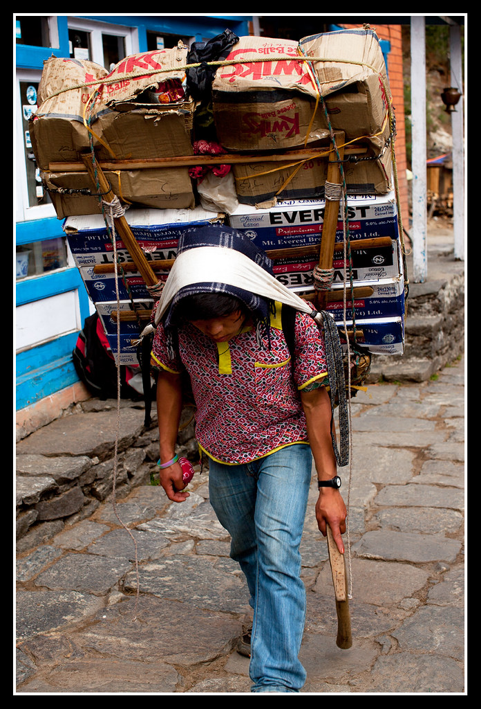 |
| All 120kg of load. Photo: Ng Kai Sing |
And Kai Sing took a beautiful picture of the very first bridge across Thado Koshi the river. I would remember this place for posterity for one day we will come trekking past here again.
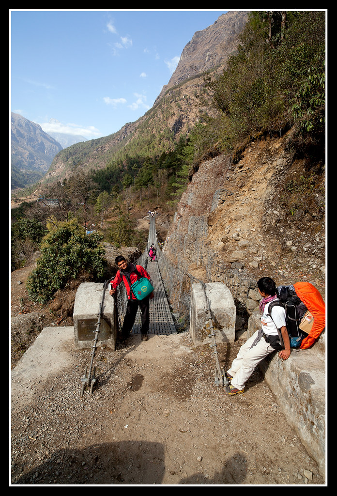 |
| A shot of one of our assistant guides Binot on this first bridge en route from Lukla to Phakding. Photo: Ng Kai Sing. |
T R A V E L O G U E
We had been walking for close to three hours already.
And to be really truthful, there was certain parts of the track that was a little uphill and thus quite breathless for those of us who were less conditioned.
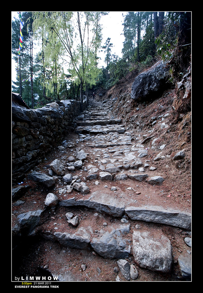
Although on this first day, the vast majority of the trek was down hill, the conditions of the track were essentially gravel and stone paths and steps carved out of rocks by hands over years, thus making walking not exactly that easy.
But of course, I was totally not qualified to comment on the track condition nor complain for I was one of the much less conditioned members of the team. Thus, as an excuse, I found myself shooting and shooting every few steps so as just to appear that I was slow due to photography.
Here is HamSum JohnnyLCP in deep thoughts up here in the mountains.
And HamSum Goose in his own deep thoughts, though the action of his deep thoughts was somewhat translated through his trekking pole to some poor soul standing in front of him... HAHAHAHA...!
And Kc Tng, Goh Su Pin and Serene made full use of every portraiture opportunity high up in the mountain tracks.
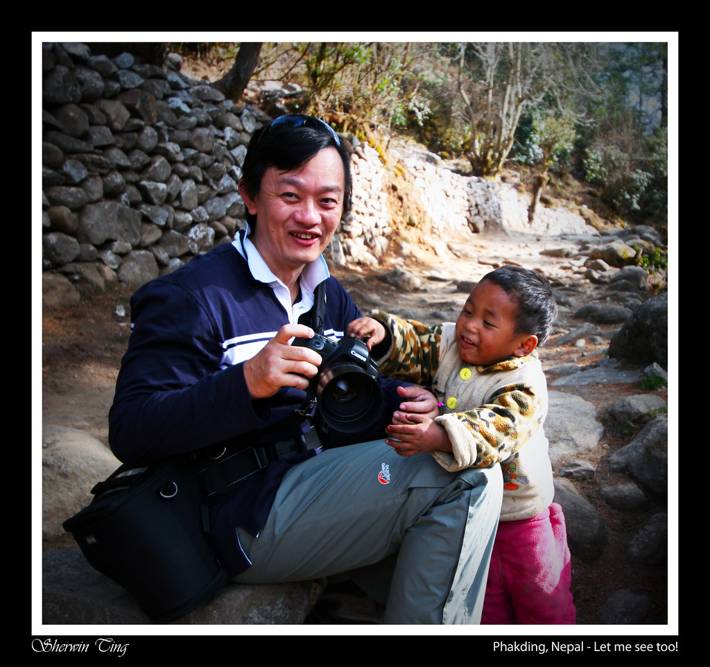
 Again, at this juncture, I must show a photo taken by Kai Sing. A beautiful shot that I will never forget. Here is it. Kai Sing always claimed to be a landscape shooter. But he is very much the Portrait shooter too.
[Click on the photo below to go to the actual post by Kai Sing on ClubSNAP]
 |
| Kai Sing's most memorable shot of a Sherpa child. |
 |
| Photo: Sherwin Ting |
T R A V E L O G U E
En Route to Phakding...
We have passed the small village of Ghat and now are cruising to another small village Chuthawa.
 e
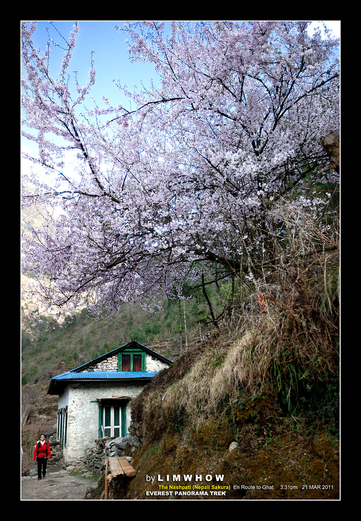
eAt this elevation of 2600m, the forestation are mainly Salla (pine) trees with the occasional Juniper. And of course, Rhododendrons were aplenty. But what was impressive was once in a while, we would come across a sprinkling of the Nepali Sakura. Mahesh, our main Guide, explained to me that in Nepali, this was called the Nashpati, and they could bloom in either white sakura or pink sakura, both colours of which we saw while on this trek.
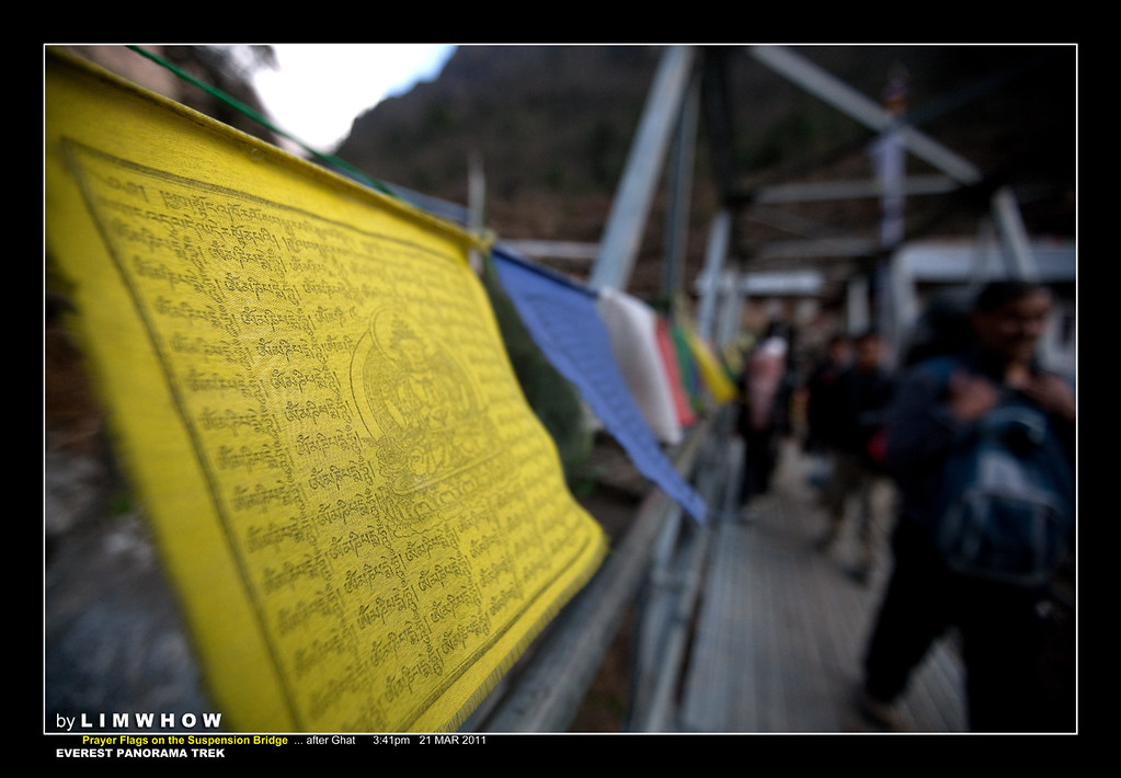
At Chuthawa, we crossed another suspension bridge, and this one had plenty of Prayer flags (Longda) hung across its length, just like many of the other suspension bridges. Only difference is, this one has, constructed across it, a framework covering its length. I remembered several porters who were stuck behind me, awaiting me to finish shooting a photo, but who were still very patient despite carrying the heavy load.
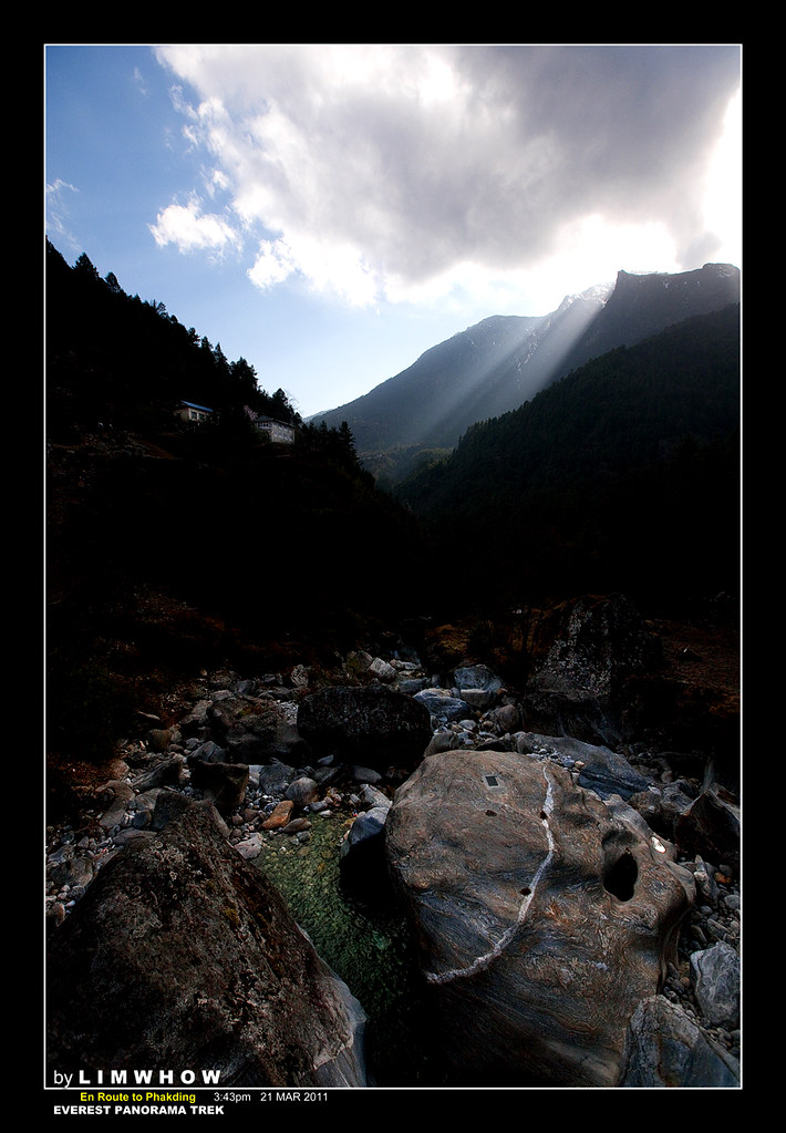
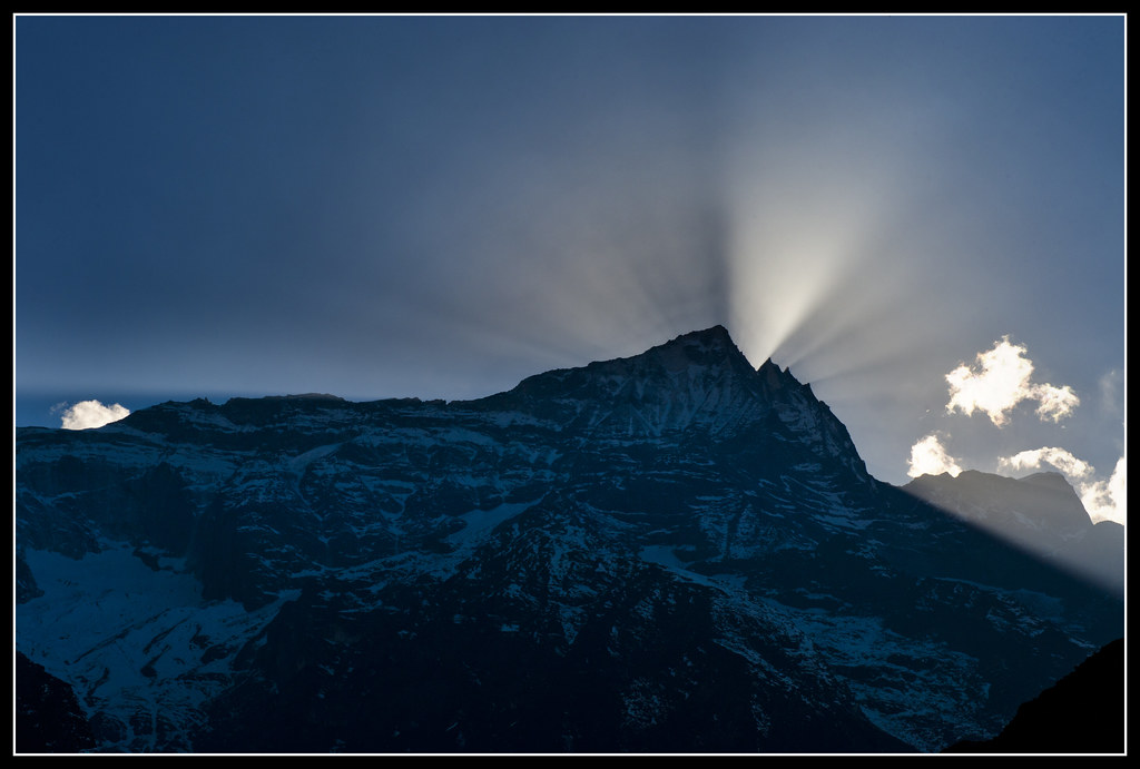
As we walked further, we looked back and saw the rays streaming through heavier clouds and this scene was pretty unique.
T R A V E L O G U E
Almost reaching Phakding...
Some of our guys were really fast. I am sure we all remembered climbing up a long flight of steps to reach this couple of houses, only to find a few of our highly-conditioned guys resting there. They have been there for quite some time ahead of us already, and they were just about to set off, at that time when we just arrived.
Steve Wong, Kai Sing, Kc Tng, Wai Kit, Wong Chin Leong, Ah Tan, Ah Leong and a few super-fit fellows were among the first few champions.
The steps up weren't the only ones going upwards. Adrian bluffed us. Going down from 2800m at Lukla to 2600m at Phakding doesn't mean everything was downhill, but had lots of ups and downs. This was merely just one of the many flight of steps upwards. Right at the end we could see Ivypin flying upwards...
Everyone would remember this out-pouching ledge where we all stood and admire the sun, the sky, the mountains and the Dudh Koshi river beneath us. It was getting a little dark as the sun was setting already. And the wind began to blow its chilled breath upon our faces and limbs.
Here, Kc Tng and Mario were taking a well-deserved breather...
Home Run to Phakding...
"Kuli Pepki," urged our private porter. "(meaning) Walk slowly."
Yah...
even if he didn't ask us to walk slowly, our shortness of breath would
naturally meant that our steps were slow and laboured.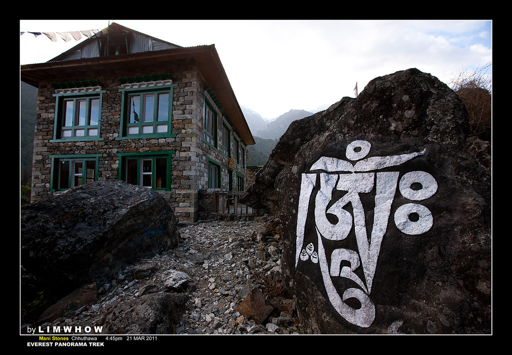
Serene and I tried our best to keep pace with Ah Leong. He was fast like the wind, despite his not-so-young pair of knees. Here, Ah Leong himself was surveying the valley at the Mani Stone pile of Chhathuwa before cheonging the last stretch up to Phakding. Francis Chia and Kc Tng were ahead getting themselves ready for the last burst of fire.
It was almost 5pm. And we had been walking for close to four and a half hours. Adrian really buay-gam one ah... he said the slow ones would reach there in four hours, but now we were all still struggling somewhere out there.
From the Walkie Talkie conversation Melvin had been having with Adrian, we came to realise that our front guys had already arrived at Phakding at around 5pm. Shucks... it would take us another one hour before we stumble upon the much-awaited small village, and our warm meals and beds.
FINALLY! PHAKDING...!
Yah. We finally arrived at Phakding.
Who could forget this one last long long suspension bridge stretching across the gorges of the Dudh Koshi that took us right to the doorstep of The Sunrise Lodge, our rest place for the first night.
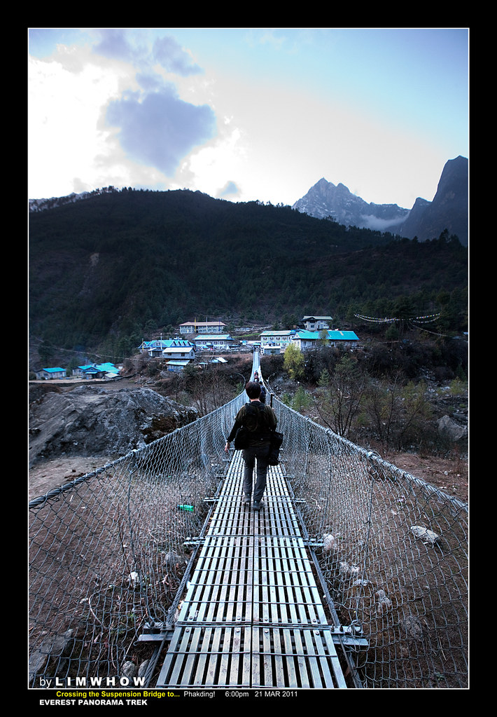
A shot by Serene
Finally arriving at the guesthouse at Phakding...

Day 5: Phakding - A good rest for an even tougher climb the next day...
Like what SgTrekker had repeatedly warned, the lodges in the Everest Country were all very basic. There was no heater facilities, and hot water for shower was not a guaranteed luxury. For those that had hot water, one would often need to pay 150 rupee per use (S$2.70). That was the main reason why Adrian and Melvin kept prompting us to get ourselves sleeping bags and instructed us to sleep with all our base layers, middle layers and outer layers on, and to sleep snuggled tightly inside our sleeping bag.
At least at The Sunrise Lodge, some rooms had hot water. And those who had hot water had better quickly use the hot water to shower before the hot water got depleted. Food was the usual Chow Mein (fried noodles), Dhal Bhat, Yak Steak, Fried rice and Mixed Thukpa (noodle soup). Beverages were the usual hot lemon, hot ginger tea, milk coffee, hot chocolate and beer. But our good team members brought their own Vodka and Whisky to celebrate the special occasion!!!
Cheers to Johnny, Goose Goi, Jack & Wife Cheryl!
A beautiful Sunset shot by Kc Tng at Phakding.
 |
| Sunset at Phakding. Photo: Kc Tng |
Every night on the trek, we'd arrive at our destination in the late afternoon or early evenings, and we'd all be in bed by early night as there was nothing much more to do. That, of course, meant that we would need to wake up early in the morning for our set offs were usually early right after breakfast.
So, on this first night. We all slept soundly. Well.... at least most of us did.
CLICK HERE BELOW TO CONTINUE TO THE NEXT CHAPTER:
Day 6: Phakding to Namche Bazaar
No comments:
Post a Comment