Nubra Valley, Ladakh Medical work
Day 5, 19 July 2018 A Day of Adventures!
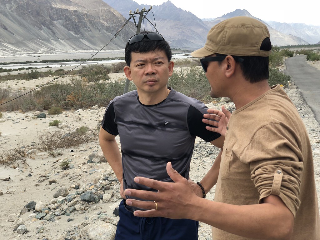
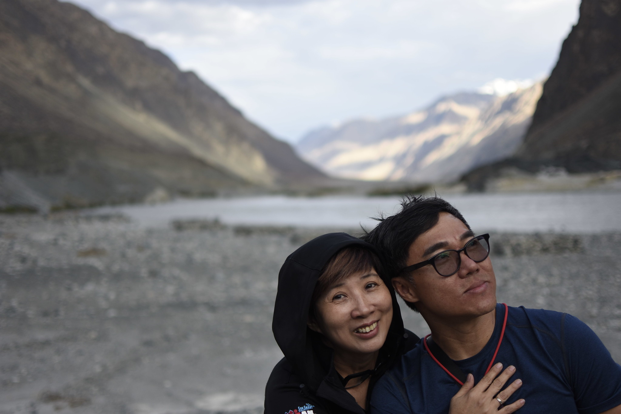
Early this morning at breakfast Roy and Terence were discussing with Wangyal what was the best way to trek to the nearby waterfall. It was just near the guesthouse. They were mentioning some glacier thingy...
“How long will it take to reach the glacier?” asked Roy.
“4 hours,” gestured Wangyal.
“4 hours! Ok what, can do ah...” Roy was quietly confident.

“No, 4 hours to the mountain, and then another 4 hours to the glacier,” revealed Wangyal. And Roy gave up.
And the plan for the glacier was scrapped.
Here is the VIDEO for Day 5
The Hiker's adventure to the Waterfall, the Monastery and the Lake...
Here is the VIDEO for Day 5
The Hiker's adventure to the Waterfall, the Monastery and the Lake...
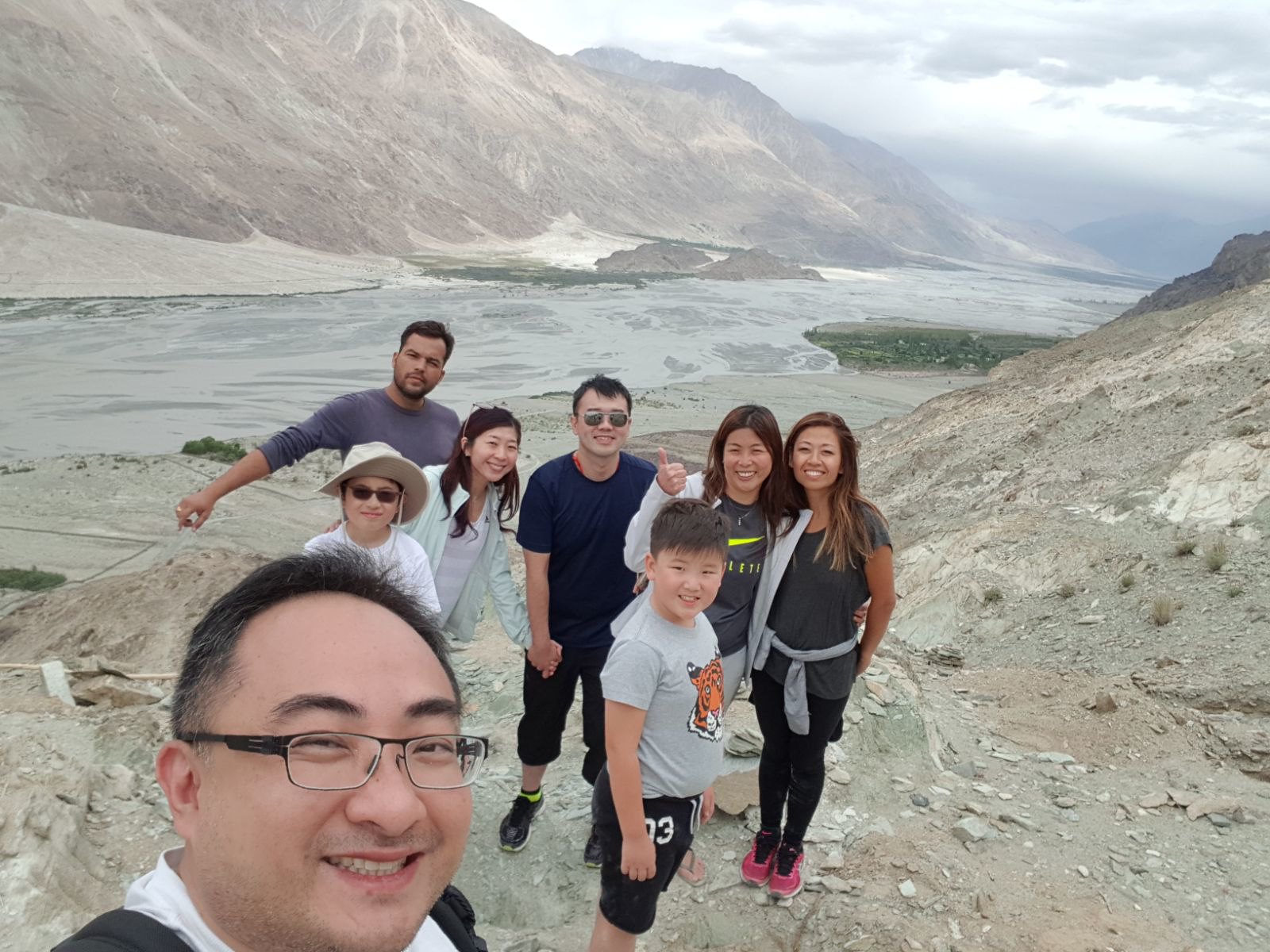
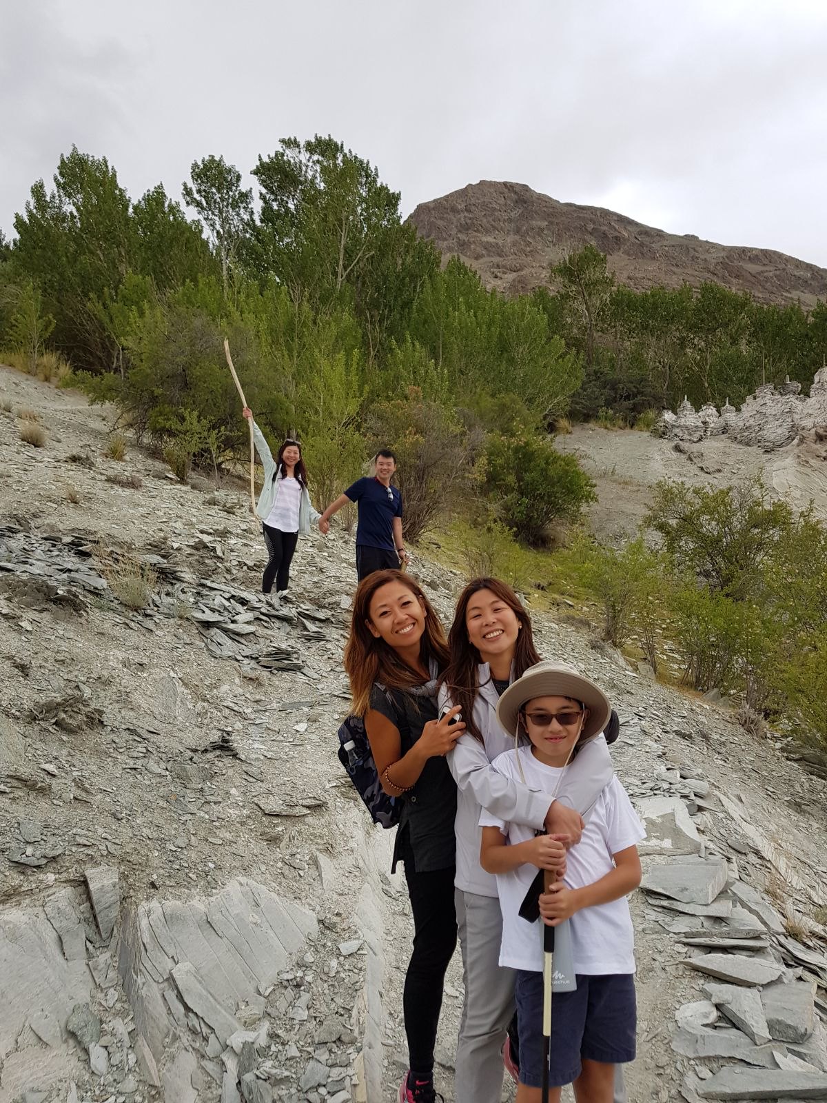
Eventually Roy’s trekking group evolved into a hike to the waterfall followed by a trek to an old monastery, thereafter to a lake.
 |
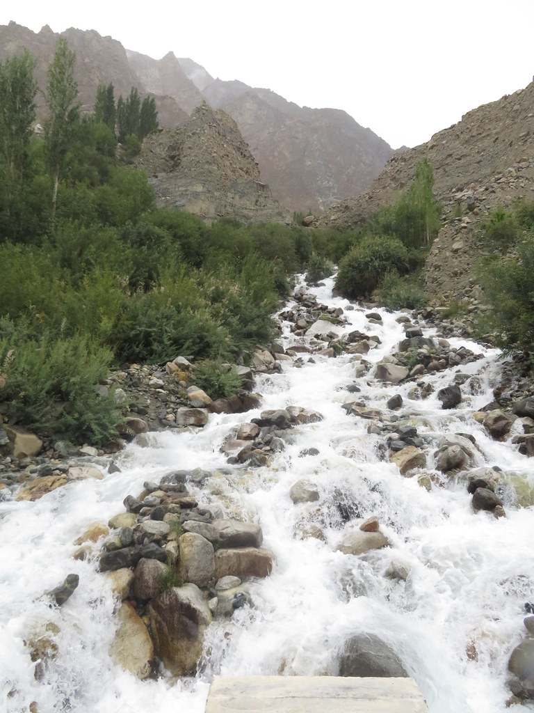
| I was sure Roy and company were enjoying the nice cool hike up the mountain. |

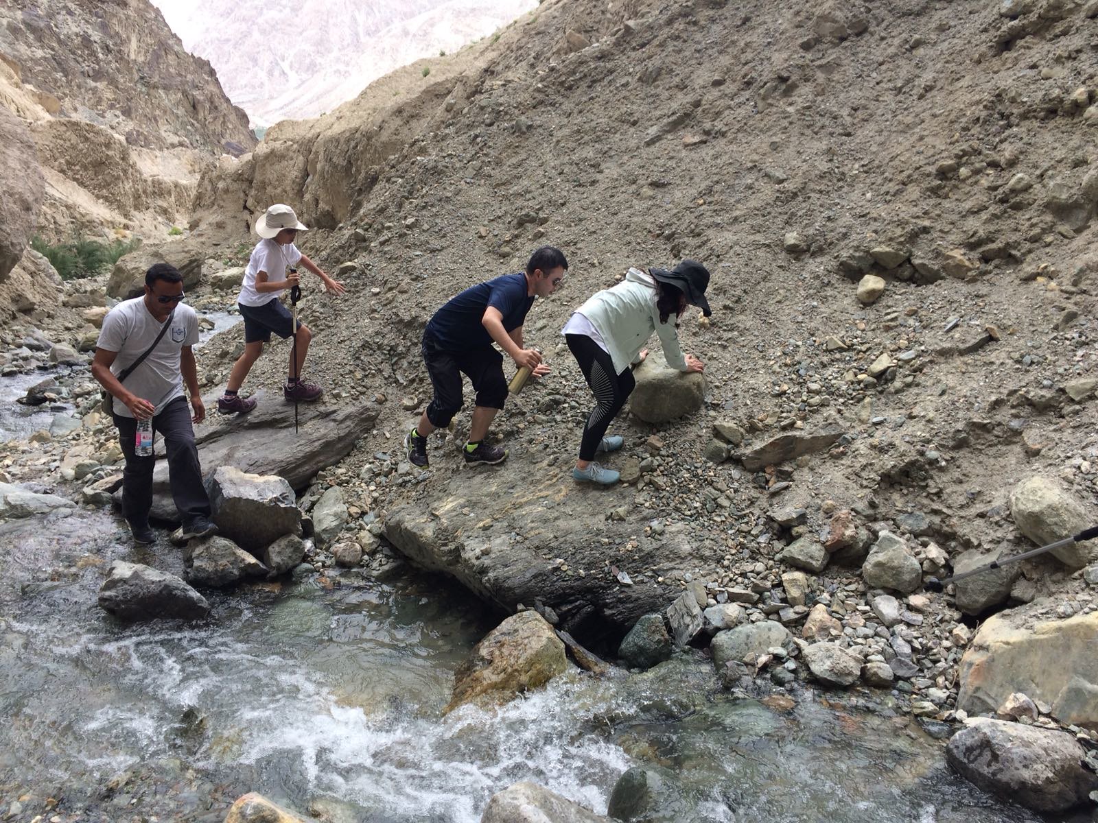
The hike to the waterfall that was initially supposed to be 15 mins ended up to be one and a half hour.
“We had to cross some streams, gotten our shoes wet and then we reached the waterfall,” said Vanessa afterwards.
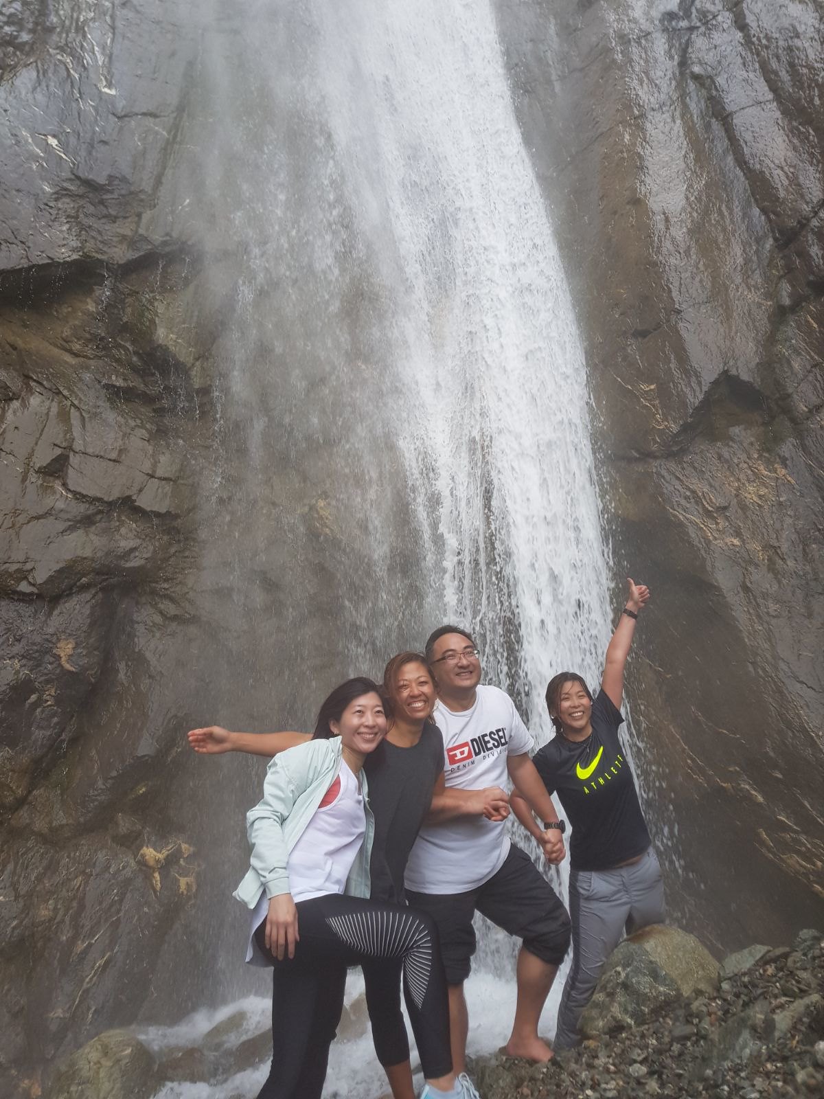
“It was so cold up there at the waterfall,” exclaimed Hanjing.
“Was it tough?” I asked.

“No lah. It was gradual slope, not that bad lah,” replied Terence. “Up there we arrived at an old monastery where they had photos of all the previous Dalai Lamas and had oil lamps. Bikky pushed open the door of the monastery and we went inside. It was a good discovery.”
 |
| On all fours going up the slope leh.. where got not tough? |
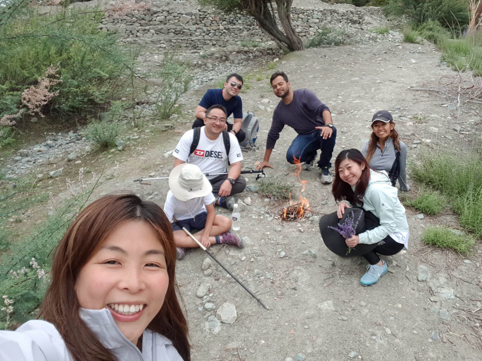
So with Roy leading and Bikky guiding, the gang made their way up the nice trekking route to arrive at the waterfall one and a half hours after starting.
"I've always wanted to find out how the waterfall looks like, after we saw the stream the last time. I was sure there is definitely a waterfall somewhere up there," insisted Roy, and therefore this hiking trip.


 |
| Even Neelam needed to have a stylo mylo shot of himself at the waterfall. |
Terence: "We set up an outdoor fireplace to keep ourselves warm and everyone gathered around. It was quite fun."
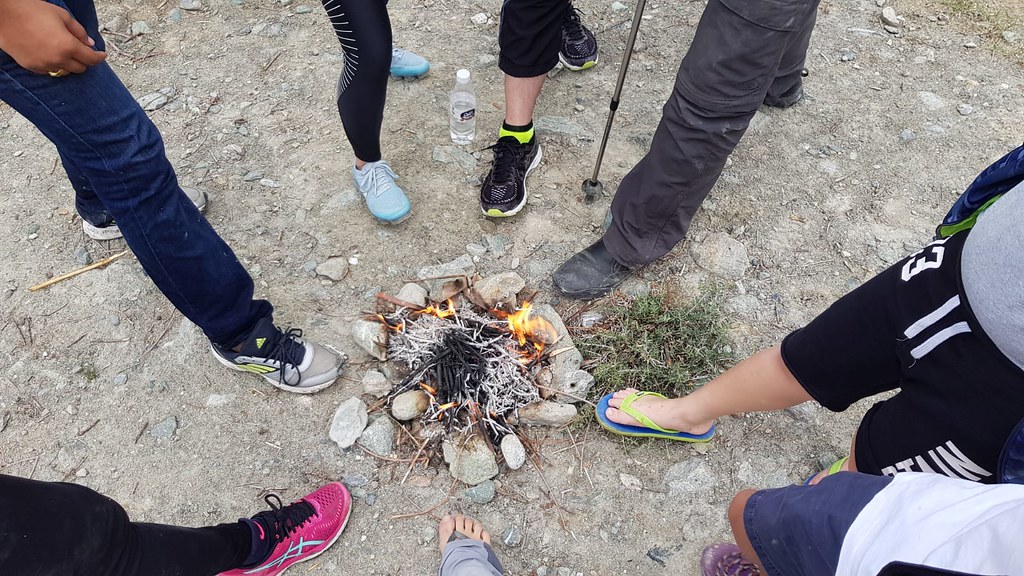 |
| All desperately trying to dry their wet shoes. |
Venessa said later back in the guesthouse while she was sunning her shoes: "Wah lau.. we had to walk through the stream, and by the time we reached the waterfall all our running, trekking shoes were all wet. But bo bian lah.. it's part of the experience. "
That sounded like a real adventurous hike. Something that I would like to do myself. But on this day my main aim was to visit that last village before the Indian-Pakistan border, Turtuk, and to visit the old King.
The History Buffs' adventure to the
India-Pakistan border... Onwards to Turtuk!
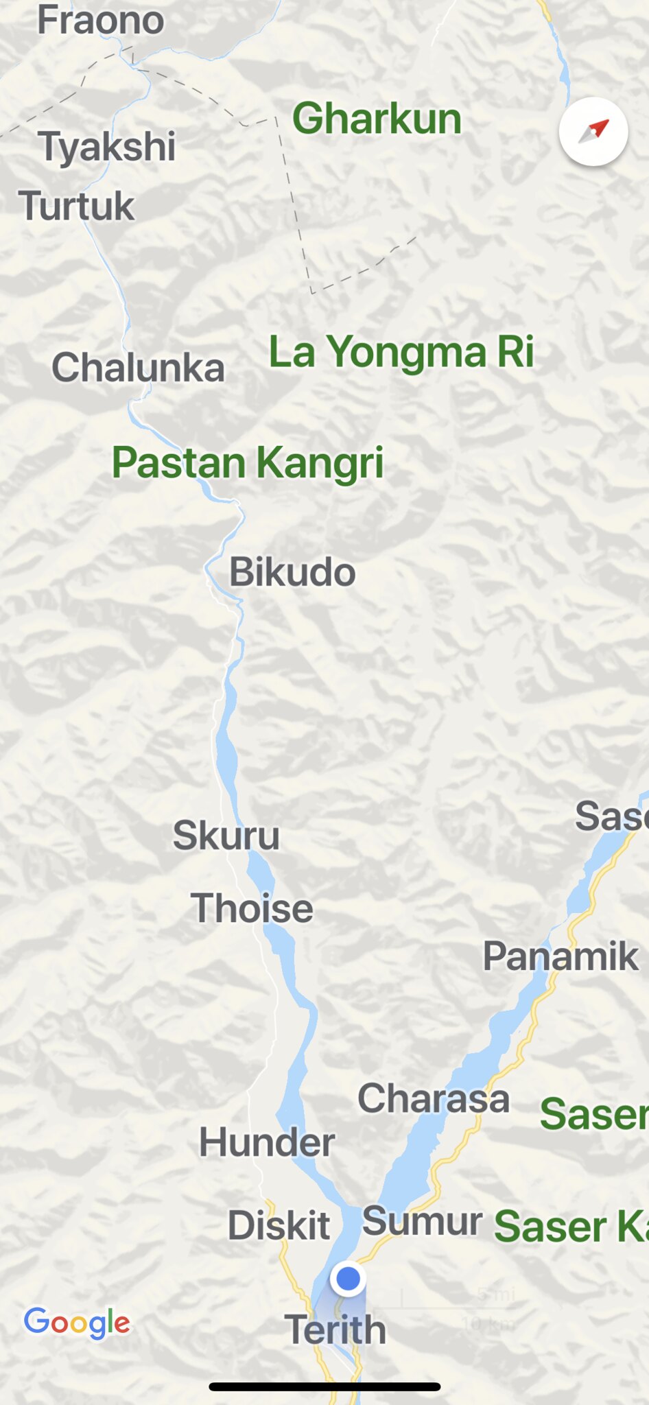 |
| Can see how we travelled down south from Sumur to Terith and then back up north to Diskit, through Hunder, Bikudo and then finally to Turtuk. A long drive. |
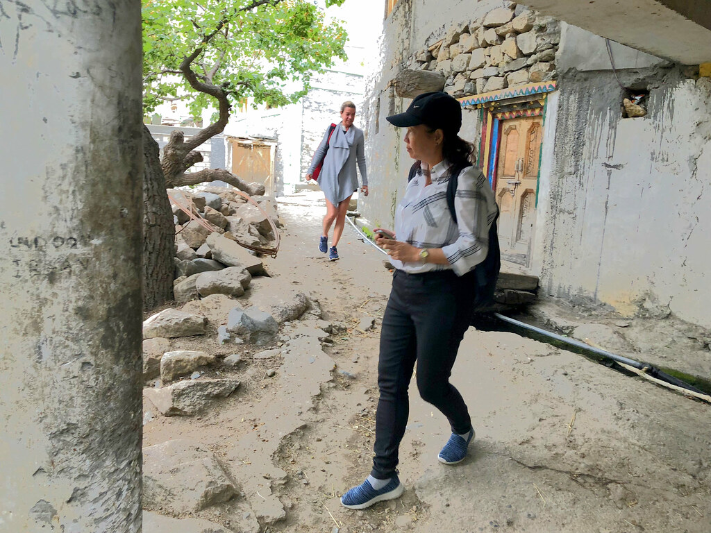
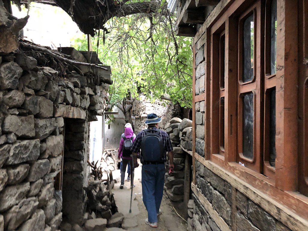
For those of us who missed the fun of the hike, we chose instead to explore the ancient village of Turtuk, at the border between India and Pakistan. This had been something that I had always wanted to do. So I was not going to let this chance pass.
We left Wangyal’s guesthouse at about 10am, and started towards the opposite arm of the U-shape route again towards Diskit and Hunder and from there up north towards Turtuk.
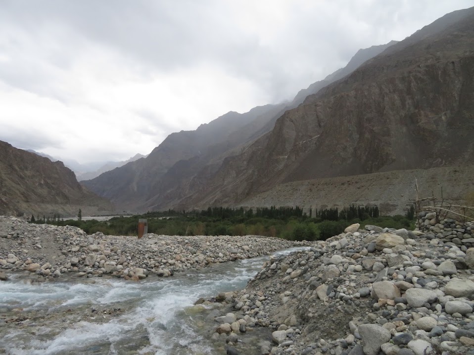
The route brought us through some rugged terrain with some passes with over-hanging rock-roofs and we were heading closer and closer towards the border, with the Ladakhi ranges to our left and the Karakoram ranges to our right.
 |
| Part of the Karakoram ranges |
 |
| 剁戒道:“此巴基斯坦老王,孤苦伶仃被困于印控地区47年。衣食住行都成问题。此老王及吾等,定会因 您李大夫一伙儿的光临而受宠若惊受利不浅。此君知晓大夫的驾临,直欢喜不已。还有待您速速抵达, 微臣已吩咐老王下人备足大餐宽待您一伙儿。” |
The car journey was a long three hour plus one and we all ended up falling asleep in the Jeep. At least for most parts of the north-bound drive.
 |
| Suddenly out of the desolate mountains sprung up a medical centre. A sight that I totally missed, had it not been for the fast eyes fast hands of Haw Chong. [Photo courtesy of Chang Haw Chong] |
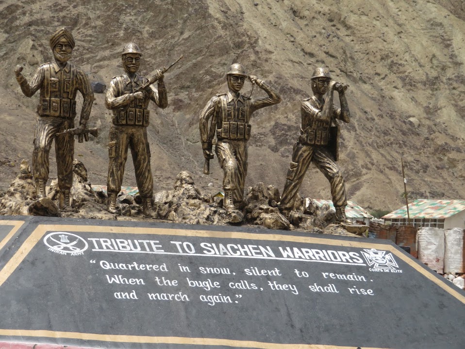 |
| The 120 Punjabi Xiachen soldiers who fought and died during the China-India war. [Photo: Courtesy of Chang Haw Chong] |
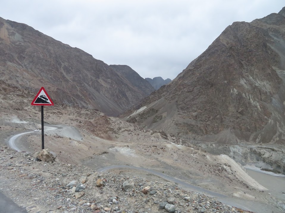 |
| Sheer remoteness characterised the journey towards Pakistan. These kind of places even the cuckoo birds refuse to lay eggs. [Photo courtesy of Chang Haw Chong] |
 |
| The Shyok River flows INTO Pakistan from here. Across these mountains we will be in Pakistan already. I could even smell Lahore from here. How exciting! [Photo courtesy of Chang Haw Chong] |
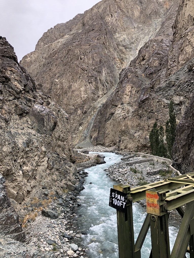
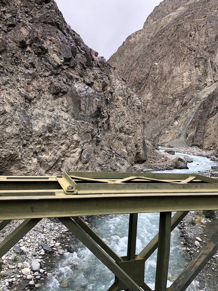
The military presence remained apparent with scattered checkpoints as we started crossing some militarily-looking bridges.
We were drawing closer and closer towards Turtuk.
And once we passed the village of Bikudo, we were getting closer already.

Excitement mounted within me as I saw bridge after another bridge. It gave me a feeling of heightened military entrenchment as we neared the border.
Finally at 2pm, Turtuk was upon us.

The history of Turtuk

 |
| The Shyok rushing its water all the way across the border into Pakistan. [Photo courtesy of Chang Haw Chong] |
Turtuk is the ‘Baltistan of India’ being the last bastion belonging to a sect of Islam called the Sufis of the Nurbhakshiya order, which is different from the Sunni Muslims in Kashmir and the Shia Muslims of neighbouring Kargil and Iran.

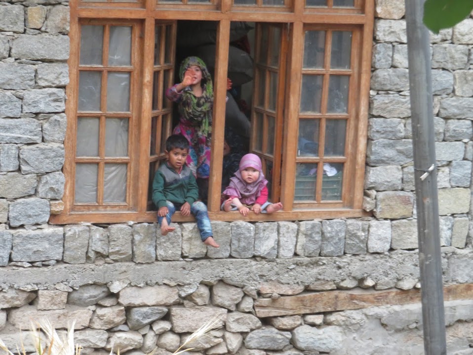
We were warned not to take photos of any person here in Turtuk unless we had first asked for permission. It was understandable, as this was a conservative Nurbashiya Sufis Muslim hamlet and we had to be very careful not to incur the wrath of the conservative villagers.

 |
| Some of the local children were happily sitting on the window sill. I could only steal a quick shot from afar. |
 |
| "NO PHOTOS!". But this Chang Haw Chong very good! Stealthily zoomed in from afar to shoot what I could not. [Photo: Chang Haw Chong] |
Since we could not take an photos of the villagers, we ended up 'you shoot me, I shoot you, and we both shoot them."

 |
| The Jamia Majid being rebuilt with the ancient 16th century minaret. |
Little known to us, although Baltistan is now an islamic province, in 745AD when it was still ruled by Tibet, the people here were Buddhist and their Baltistani language was a Tibetan dialect (although not comprehensible mutually with the Tibetan that is used in Lhasa) that used the Tibetan writing. Even after the locals were converted to Islam, their languages even until today, and their writing remained Tibetan. It was only later that the Baltistani started using Persian writings to document their still-Tibetan language. There was a recent move to revive the re-use of Tibetan writing to document their language once again.
Baltistan has been ruled for centuries by dynasties of kings and suffered multiple invasions by the Kashmir kings over the centuries. The current king, King Mohammed Khan Kacho traced his Yabgo dynasty lineage back to the 15th century, and was especially proud of his grandfather who petitioned to the High Court in Lahore, Pakistan, to order the Pakistan militaries to vacate his palace.
Baltistan has been ruled for centuries by dynasties of kings and suffered multiple invasions by the Kashmir kings over the centuries. The current king, King Mohammed Khan Kacho traced his Yabgo dynasty lineage back to the 15th century, and was especially proud of his grandfather who petitioned to the High Court in Lahore, Pakistan, to order the Pakistan militaries to vacate his palace.
Baltistan had existed side by side with Pakistan and Afghanistan. But after the India-Pakistan war of 1971, Turtuk was cut off from the rest of Baltistan when the Indian-Ladakhi army marched into Turtuk.
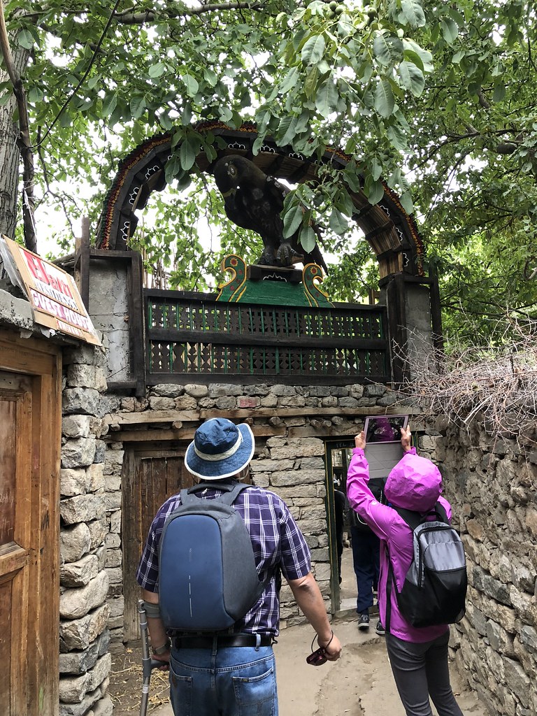 |
| Finally, we arrived at the Yabgo Royal Palace Turtuk, signified by its emblem, an old big bird of unknown species on top of the gate. Quite apt, I thought. an old bird for an old kingdom. |
What was left was this little village of Turtuk where the peasants depended on agriculture as a means of living, e.g. growing apricots.
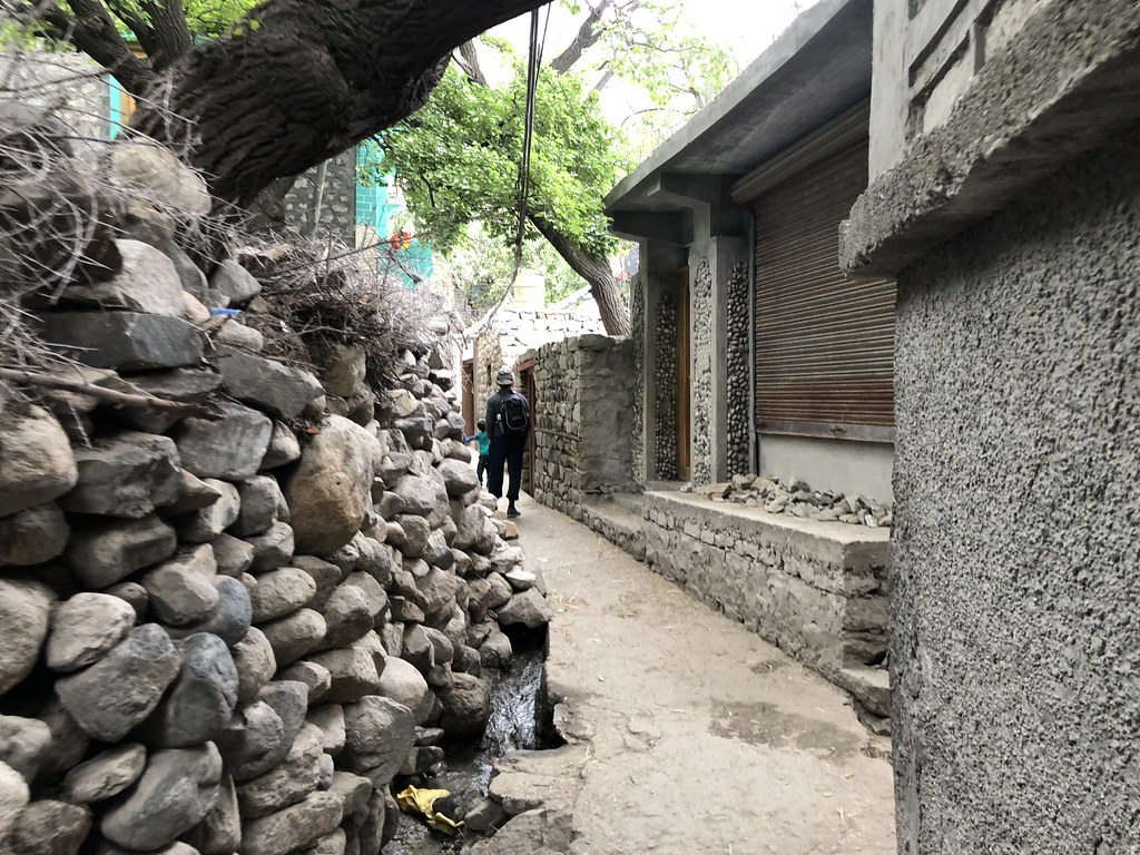
The little alleys meandered along rows of houses, some obviously very old, others in the process of being rebuilt, as the village started redevelopment over the past decade with tourism slowly increasing. And the central mosque, the Jamia Masjid was in the process of being rebuilt, but with the ancient 16th century minaret transported from afar and incorporated into the new building.
Old wizen women carrying walking sticks and stalks of barley limped slowly through their wooden main door, and several bearded old men sat on the steps of the front of their houses slowly reminiscing. Young little children run up and down the pavement.
Once we walked into the village, it was as though we were transformed into another world. The facial features of the people with their light brown hair and fair skin with pale brown eyes were of a different stock from the Ladakhis.
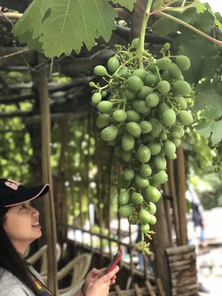 |
| Felicia enjoying the view of the Yagbo grapes. [Photo: Serene Gan] |
Slowly we enjoyed the process of following the alley until we came to the entrance of the old palace- the Yabgo Royal Palace of Turtuk. This was where King Mohammed Khan Kacho and his family lives. His whole extended family still lived in the Pakistan side of Baltistan today and although they were only 25km apart from his siblings, he could not simply just ride a camel across the border to visit them.

 |
| "500 rupees!" gestured Chang Haw Chong. I think he meant 500 rupees for taking a shot in this courtyard. Haha! |
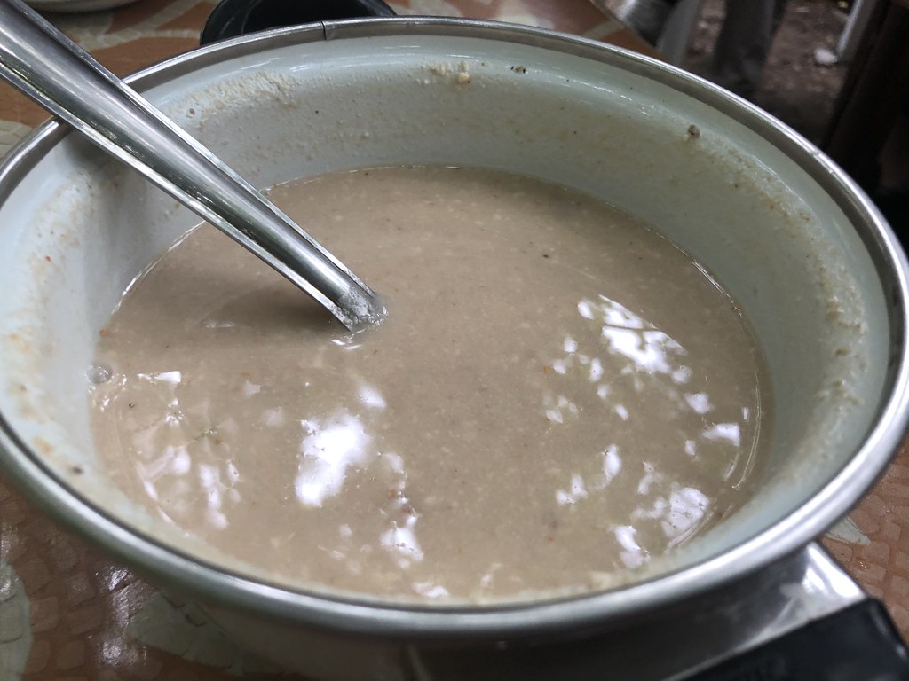
It was an old run down little building with a veranda with rooftop of twines under which the King welcomed us to a simple meal of moscut and tsamik (a very sour yogurt), to be dipped with some dough (naan).
 |
天下孔雀一般亮丽。古典的老皇居,酸不入口的道地酸奶。一位族部没落的老皇帝,
深藏不露,还挺有其一手。迎接一班好奇的来客一趟,足以供养全府大小及几百公里外之几家众生数周。
能施舍积德,我认为也是件大好事。
|
 |
| The Royal Moscut. |
"I read from the article that they specially kept the yogurt fermented in the big pot for decades so that it preserves the original tastes," explained Lay Hong to me later.
"I also ate the sour yogurt," admitted Chang Haw Chong later.
"I didn't dare to eat it," said Serene. She see ben heng ah, she.
I tried both the moscut and the tsamik with the Baltistan naan. The moscut was really spicy. I could only swallow half a mouthful of that. The tsamik was so sour it didn't make it pass my front teeth. But after what Lay Hong said, we all finally discovered the possible source of the decade-(perhaps century-?) old E.coli that gave several of us waterfalls per-anally and body aches and fever, and also started an Indian-Pakistan war in several of our stomachs.
 |
| The Royal Tsamik. |
 |
| The Royal Baltistani naan served with Baltistani copper 'giap giap'. |
When the rain finally came we escaped into his highness's living hall, a tiny little carpeted room where he sat like a King(of course, he WAS the King mah) on the sofa while we sat on the floor and were served apricots and apricot drinks. I wondered later if these apricots were also soaked in decade-old E-coli fermented juices. But they tasted sweet. So I also bo chap, and just gulped them down.

Haw Chong was the first brave man to ask to have his photo taken with the King. I guess despite the King's conservativeness, the other 500 rupees was in preparation for those courageous visitors who would even dare to ask for a photo with his highness. So of course, we all were eager to get our shots. Some more, it was the first time any one of us EVER had a shot with a real Baltistani King leh.
 |
| King Yabgo Mohammed Khan Kacho with Emperor Chang Haw Chong. [Photo courtesy of Emperor Chang] |
 |
| King Yabgo Mohammed Khan Kacho with the Hakka Royalty. [Photo: courtesy of Chang Haw Chong's fantastic high ISO Nikon] |
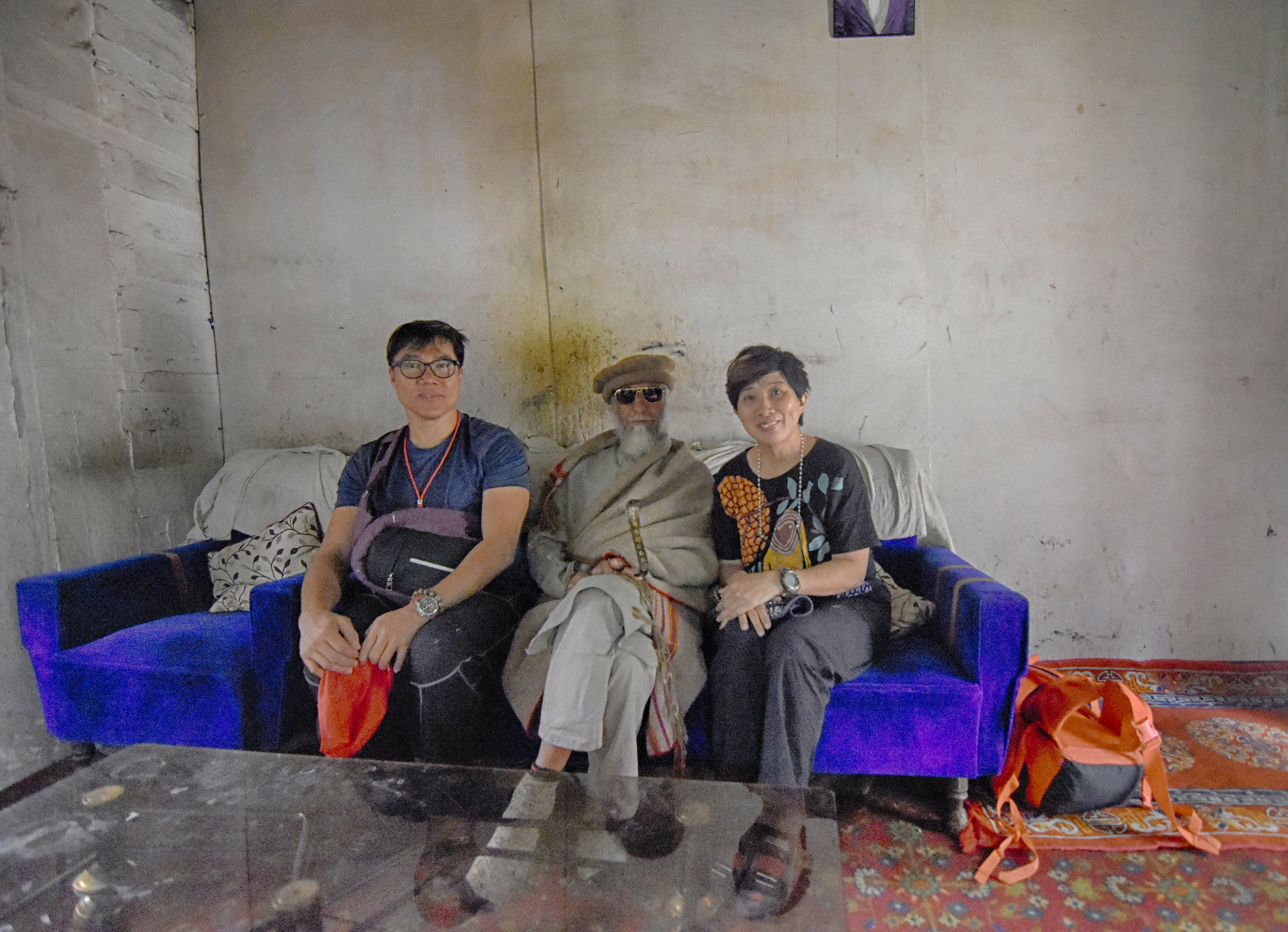 |
| King Yabgo Mohammed Khan Kacho with the Pok-gai lokun. [Photo: Courtesy of Chang Haw Chong's fabulous ultra-wide angle lens.] |

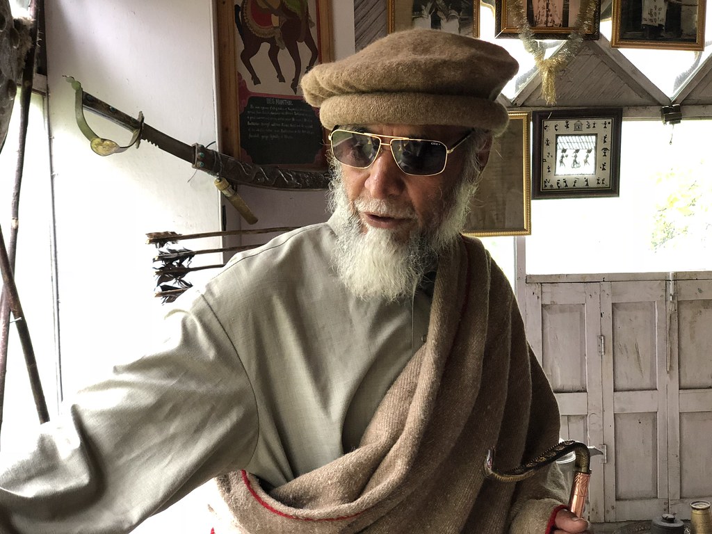 |
| And we had to trouble his royal highness to stand and explained all his grandfather and great-great-great-grandfather's stories, while holding on to his serpentine walking stick. I believe although this walking stick looked simple, it must have a hidden compartment 隐藏机关 that can shoot arrows at will. |
 |
| The King showing all us all his 无价之宝. I think they are really quite 无价. Full of historical value. |
Finally we proceeded to the next hall which had a whole wall etched in detail the whole Yabgo dynasty and every King’s name. King Mohammed Khan Kacho proudly explained the history to us, and one by one showed and explained every historical artifact - the ring that the potential King to be would be given. The Queen’s shoes, the King’s battle helmet, his father and grandfather’s walking sticks with hidden dagger in a secret compartment, the cooking pot and such. I was pleasantly surprised by the King’s command of English though with a thick Baltistani accent which made it difficult for me to comprehend.
 |
| His royal highness had his photos taken with us.. maciam like a Korean star like that. |
 |
| Me and my bulging stomach at his royal highness's front door. Photo by who else but Serene. |
It was good. I was happy. I had been brought to Baltistan. Within touch of the India-Pakistan border. To me, that was highly satisfying.
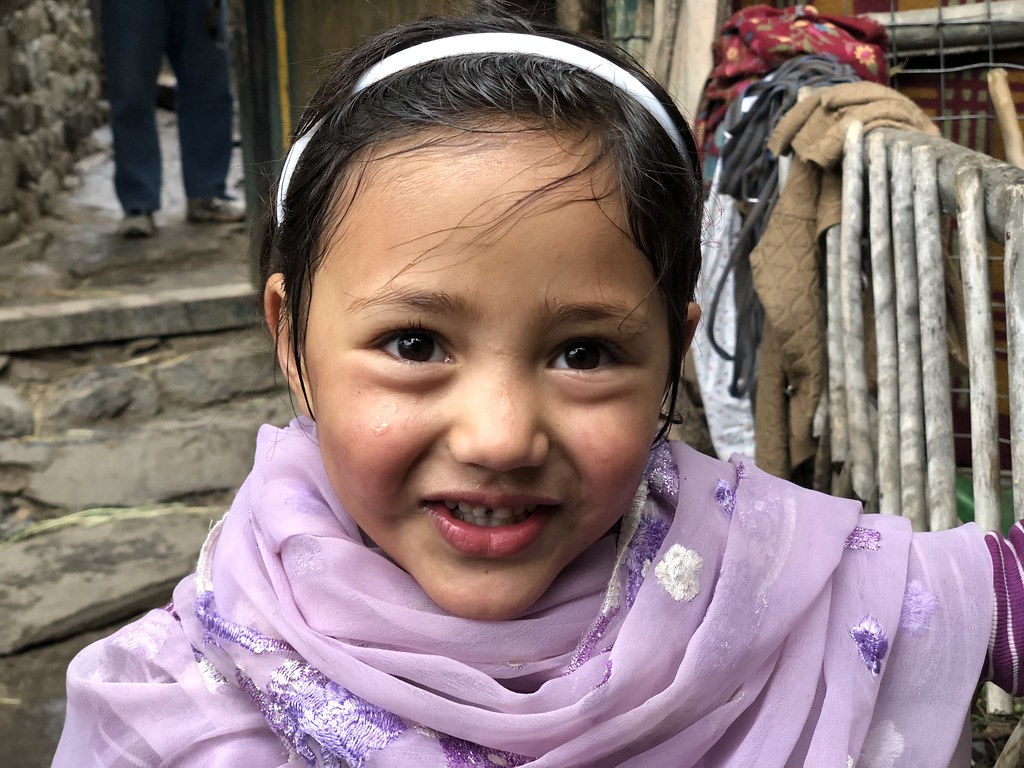
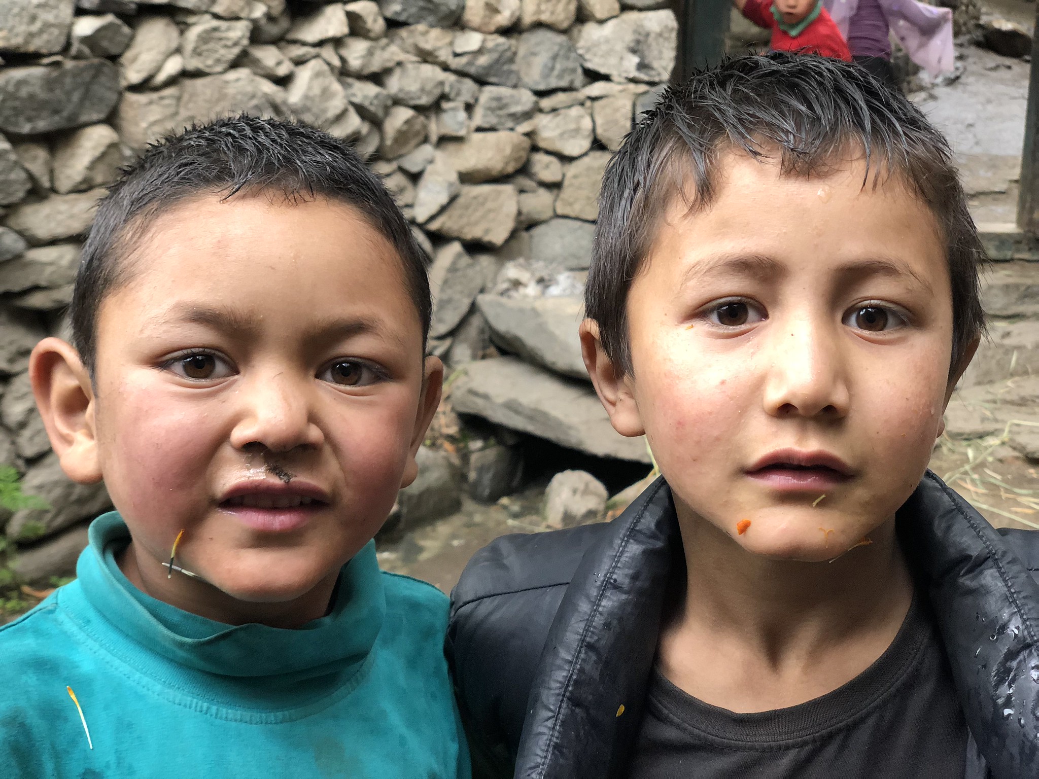
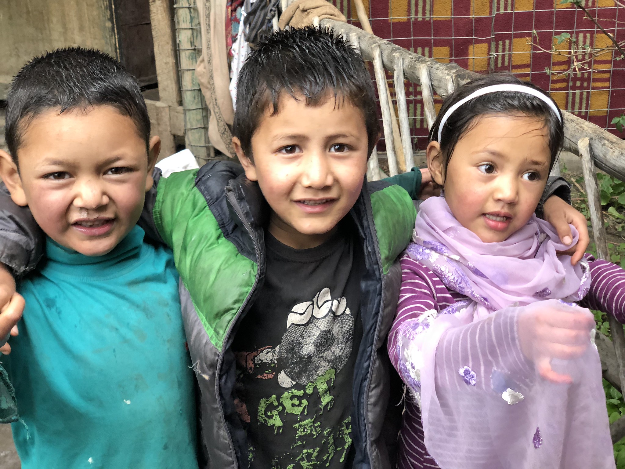
On our way back from the Yabgo palace, we managed to 骗 several local Turtuki's children's 感情 and made them pose for a few shots for us. They had lovely features.


Emperor Chang really bluff the Turtuki children's feelings... how did he managed to get them to take a group photo with him?! Marvellous man, marvellous camera!

Bye bye Turtuk...
On our way back from the Yabgo palace, we managed to 骗 several local Turtuki's children's 感情 and made them pose for a few shots for us. They had lovely features.

Emperor Chang really bluff the Turtuki children's feelings... how did he managed to get them to take a group photo with him?! Marvellous man, marvellous camera!
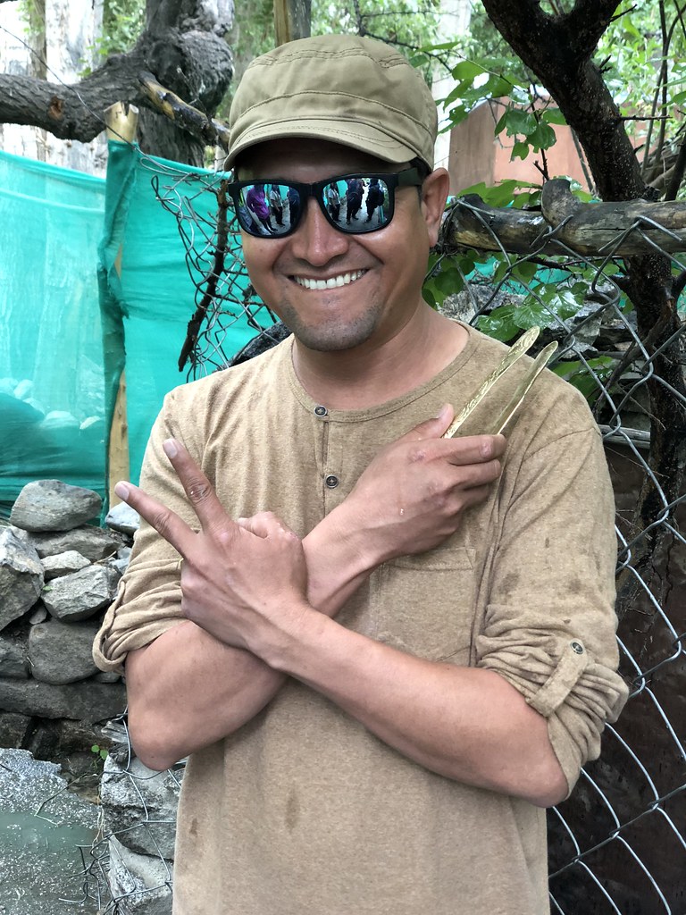 |
| Our Baltistani-speaking Ladakhi guide Dorje and his 200 rupees Turtuki 'Giap Giap'. |
Bye bye Turtuk...
 |
| A panorama at Bikudo, shot taken by Serene. |
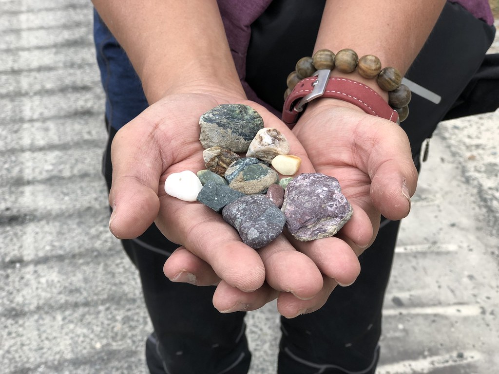 |
| My multi-coloured Bikudo pebbles and stones. But later I was made to return all of these lovely stones back to their home ground. Serene: "Never remove any rocks or stones from their native places!" Ok lor. I better guai guai listen to her. |
 |
| Dorje and Vicky on the sandy shore of Shyok River at Bikudo. |
 |
| My core muscles not up to it. Cannot balance properly. Photo: Serene. |
Back to Sumur
The three hour car trip back to Wangyal’s guesthouse was a good time for us to sleep. Broken only by a short stop after the village of Bikudo where all of us got down and walked along the road and down the sand banks of Shyok river when I had a chance to feel the cold but muddy water.
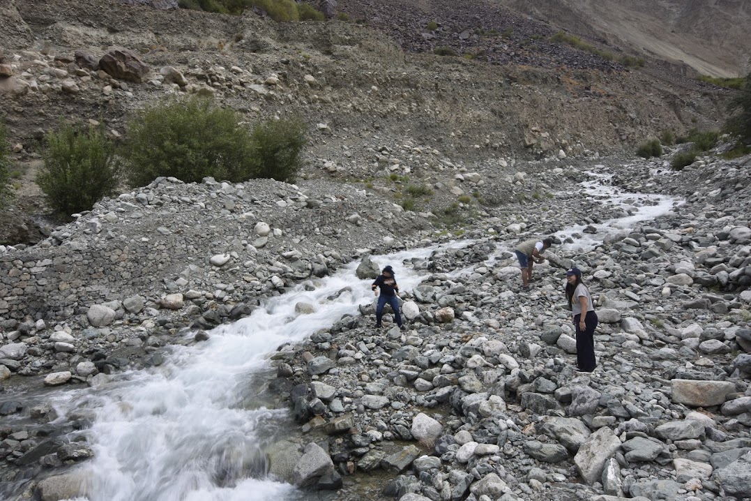 |
| Vicky, RK Pandey and Felicia perhaps trying to catch a quick water-bus ride into Pakistan? [Photo: chang Haw Chong] |

 |
| Don't say this Emperor Chang ah.. he ah, don't use, don't use. But once he opens up his 50mm f/1.8 and whacked the bokehs, way... the shots become so feelingful! |
To continue to the next day's adventure, click: "Day 6 - Bye bye Nubra Valley !"
To go back to the home summary page, click: "Nubra Valley Medical Volunteer work - a trip of discoveries"
No comments:
Post a Comment