I guess apart from some of the hilly areas around Bukit Timah, the Southern Ridges is another area that has been set aside by the government as nature reserve and designed to be linked up to allow for continuous walk, with scenice bridges and pathways.
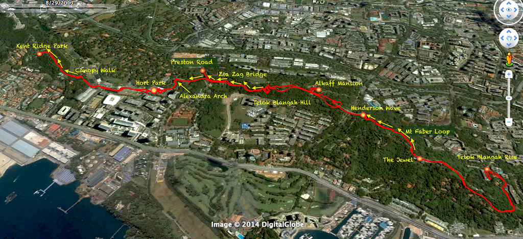
So how does the hike look like?
Here is the actual GPS track of our hike on this day. Click on the photo below and Zoom in after that to see the enlarged Google Earth map.
 |
| The Actual GPS track of our hike today |
